
 |
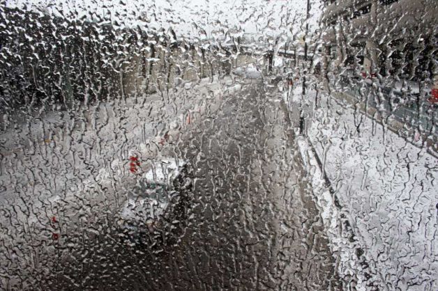
| Icy Window at Sea Tac: Picture Courtesy of Seattle PI |
One thing I think is clear...thank god for the new coastal radar. By 4:30 AM it showed that the forecast was going bad and moisture was streaming in farther north. (below is the Langely radar at 5 AM)
My colleagues in the NWS clearly understood the threat and put out an ice storm warming around 5:30 AM.

With precipitation streaming northward and cold air in place we have mixture of snow over the north Sound transitioning to sleet in the central Sound and freezing rain in the south. There are reports of 1/2 inch to one inch of freezing rain in the south and southeast Sound area (e.g., Olympia, Puyallup), with many downed trees and extensive power outages (over 100,000 customers reported by Puget Sound Energy, Tacoma Power, City Light).
Here is a neat figure showing the winds and temperatures in time over Seattle (time increases to the left, height in meters). You can see the southwesterly/southerly winds aloft associated with warmer temps, a thin layer of southeasterly air below that, and cool northerly flow near the surface. You can also see the descent of the freezing level over time.

At noon the back edge of the precipitation area (image) is apparent offshore, but clearly we have several hours more of this moderate snow/sleet/freezing rain event.

By tomorrow morning the winds should shift to the south at low levels with warmer temps. The end.
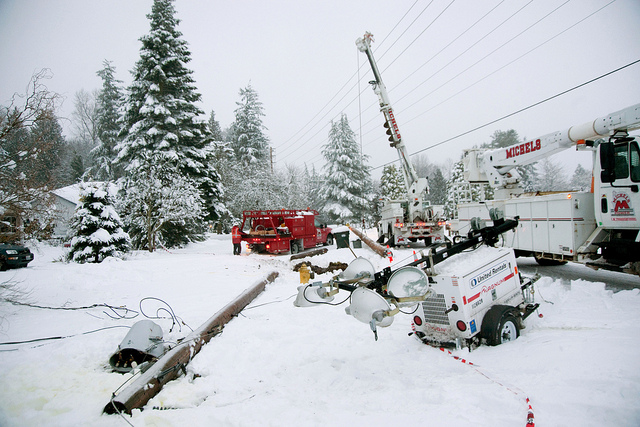 |
| Picture courtesy of Puget Sound Energy |
 |
| Icy Seating at Sea Tac: Picture Courtesy of Seattle PI |


