Portland is Hot, But Seattle is Cool

| comments

As we enter the warm portion of the year,  differences between Portland and Seattle temperatures are again becoming evident.  Seattle has a far more maritime climate than Portland and thus is considerably cooler during the summer.   In fact, the Willamette Valley as a whole has a far more continental climate than the Puget Sound basin. 

To illustrate this situation, consider some topographic maps.  Seattle is clearly open to the influence of cool waters, with Puget Sound at its front door and a sea level path to the Pacific Ocean.  With water next store and high pressure offshore, constantly pushing marine air into the Puget Sound interior, it is hard to get the Puget Sound lowlands in the 80s or 90s during the summer.  Only when we have strong offshore and downslope flow can Seattle and vicinity get toasty.

But Portland and the Willamette Valley are another story!  The Willamette River or even the Columbia is no Puget Sound, and the Willamette Valley is surrounded by mountains or high hills on all sides, thus isolating it from the marine influence during the summer--a period when the Pacific cool, marine layer is relatively shallow and unable to surmount the terrain.  Thus, it is far easier for Portland to bake...and it is not unusual for the high temperatures from Portland to Eugene to be 5-10F warmer than Seattle...sometimes much more.


Lets begin by looking at the monthly average maximum temperatures at Seattle, Portland, and Salem.
Consider July.   In that month Seattle has an average high  of 75, Portland gets to 79, and Salem, a torrid 82F.  Not need to head to Hawaii...drive down to Salem.  But look at the winter high temperatures...there is very little difference among these three stations...and that is not surprising. With strong, deep flow coming off the Pacific and lots of clouds, we all suffer with cool, wet conditions.


But the mean monthly temperatures tell only part of the story...what about the extremes? Below is a plot of daily means and  extremes...lets consider the daily extreme high temps (yellow colors).  Seattle has only gotten above 100F once---103F in July 2009.  But for Portland, daily records above 100F are numerous and above 90F commonplace over most of the summer....very different than Seattle!


Lets illustrate with last summer:  here is the plot of temperatures at Portland (green line) and Seattle (red line for July 1, 2011 to Sept 1, 2011.  Portland is warmer on virtually every day, sometimes by as much as 10F.  They just don't have Seattle's natural air conditioning.  But they do have better food trucks, several of which sell cooling drinks and ice cream.
And if you think the Willamette Valley is warm during the summer...it is nothing compared to the next basin to the south...the one including Medford and Ashland.  They laugh at 100F temps down there....but that is a story for another day, and one that includes fog during the winter.


Extraordinary Skill for Extended Weather Forecasts

| comments

How far into the future are weather forecasts skillful? 

By that I mean:  how far into the future can we forecast specific weather features--perhaps the intensity and position of a low pressure center or the position of a front or whether they will be rain during the early morning hours.   Such forecasts contrast with climate prediction, where we attempt to predict the general nature of the weather over a period...say the average temperatures for the spring.

Lately we have increasingly seen forecast skill extend well past a week...and in some cases, extending to nearly two weeks....and in this blog I will show you a few examples.

A lot of research was done on this topic--determining the limits of predictability-- both from  theoretical and modeling perspectives.  For example, meteorologists such as Edward Lorenz and Joseph Smagorinsky would run weather forecast models many times, each starting from a SLIGHTLY different beginning--well within observational error.  They would see how long it would take before the forecasts would become very different.  Generally, it took about two weeks, but there is nothing unique about that period.   Sometimes forecasts would diverge after a few days, while in other situations the forecasts held together much, much longer.  The implication is that during some periods we find that forecast skill, even with a perfect forecast model, is lost quickly, while in other periods we might skillfully predict the weather for weeks.
The ability of a small change in the initial forecast state to eventually cause a big change in a forecast is known as the butterfly effect, since the atmospheric disturbance of a butterfly flapping its wings would eventually alter a forecast a long time into the future.

In the early days of forecasting, when our forecast models were crude and our observational resources were few, weather prediction could not get close to the theoretical limits.  But during the last decade or so, with the availability of satellite data, fast computers, and far better computer models, prediction skill has extended further and further out in time.   In the 60s-80s we were lucky to skillfully forecast out 2-3 days.  In the 90s 3-4 days.  And in the 2000s, 4-5 day forecasts were often quite skillful.  But recently, we have seen highly skillful forecasts consistently at 5-7 days, and occasionally approaching two weeks.

Want to see some examples?  Here is a 360 hr forecast (15 DAYS) from a National Weather Service ensemble weather prediction system for the height of the 500 mb pressure surface.  Specifically, it shows the predicted anomaly (difference) from normal of the mean of a large collection of forecasts (the ensemble).  Note the HUGE (orange color) high height anomaly in the north Pacific.


 Next, here is a 192 hour (8 day!) forecast valid the for same time.  The feature is still there.

Finally, here is a 24-hr forecast verifying at the same them..this should be pretty much exactly what happened.....the feature is still there...albeit distorted a bit.  You will note that the 192 hour forecast


 got a number of other features correct...or nearly correct...as well.

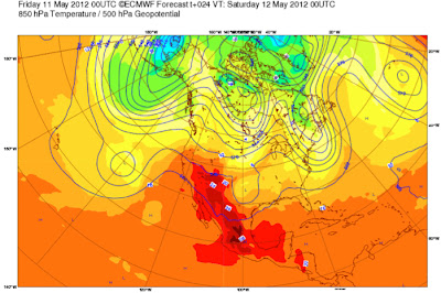
Or examine the 240 h (10 day) forecast by the European Center for Medium Range Forecasting and compare it to the 24 hour forecast for the same time.   The images below show 500 hPa heights and 850 hPa (around 1500 meters) temperatures.  Not perfect, but a number of features are very similar...useful forecast skill there!


Or a recent example--a forecast at 500 hPa made 7.5 days ago for today at 5 PM....and a 12-h prediction for the same time.  A lot of the same features, although there are some minor differences in phasing and amplitude.

The general consensus is that we will see such skill extend out further in time, by at least one day per decade.   There is a limit to this extension of forecast skill...but there is much we can do to improve our predictions more--so improvements should continue for a while.

So when people ask you how far into the future meteorologists can predict the weather, a good answer is:

2-3 days with excellent skill
3-4 days with moderate, but useful skill
5-6 days with marginal skill
..and occasionally skill extending out 7-10 days.

Yes...sometimes forecasts go wrong in less than a day...but is considerably less frequent than a decade ago.


Strong Thunderstorm Hits Portland

| comments

 For the second day in a row,  convection and thunderstorms developed over the Cascades and rolled into the western lowlands...in this case hitting southwest Washington, Portland, and the northern Willamette Valley.   Mark Albright, past WA state climatologist, reported that an observer in downtown Vancouver just W of I-5  reported 0.40 inches of rain in 5-minutes from 19:29 to 19:34 PDT 26 May 2012.  The highest hourly amount from the Portland Hydra network (46 sites) seemed to be the 1.34 inches over one hour from 19:00 to 20:00 PDT reported at Hayden Island just west of I-5.  This is extraordinarily heavy precipitation--heavier that the downpour that hit Seattle in December 14, 2005.....the event that flooded parts of the Madison valley.  Most gutters simply can't handle this intensity.

Take a look at the Portland radar at 7:26 PM Saturday....see those reds?...that is torrential rain.


Here is the storm total precipitation from the radar...you can see the track of the heavier rainfall.


Did the models get it right?....unfortunately, not....again they failed.  As proof, take a look at the forecast 24 h precp ending 5 AM Sunday....not good.  This summer I plan on examining this event in detail....hopefully finding the origin of this failure.  But convection is hard to forecast, particularly weakly forecast convection.


Here are two good youtube videos of the event:


First one.
Second one


Falling Trees, Thunder, Strong Winds and a Problem Forecast

| comments

This morning I didn't plan on biking home in strong winds, rumbling thunder, light rain and a blocked bike trail....but it happened.  During the second half of the afternoon thunderstorms developed over and to the west of the Cascade crest and then moved over the Puget Sound lowlands.  Strong outflow from the thunderstorms produced gusts of 30-40 mph, causing branches from the well-leafed trees to break off and descend upon surprised local residents. (the leaves enable the winds to do more damage to the trees than would have been the case a few months ago).

This is what was waiting for me on the Burke Gilman trail around 7 PM...and much of the trail was covered by small branches and torn off leaves.


The winds came up suddenly as the thunderstorm cells approached...here is the wind observations on the Evergreen Point floating bridge:


 It should also be considered that there is considerable danger when there are strong wind and you are near big trees.  The strong winds were over when I entered the wooded portion of the trail...and I was still a bit nervous.  People have been killed and injured by falling trees--even in cars--so you got to be watchful.

Thunderstorms often have strong winds associated with downdrafts produced by rain falling out of the storms.  Not only does the rain drag the air downward, but evaporation cools the air, making it more dense and thus heavy.....allowing the air to accelerate towards the surface where it is forced to spread out as a fast current.  The transition to these strong outflow winds is called the gust front.   Not only can it knock down branches or trees, but there can be danger on the water if you are in a sailboat.   I was involved in a legal case once where some fell off a sailboat when a gust front hit--there didn't make it.

The cam on top of the atmospheric sciences roof showed the building cumulus over the Cascades at 3:15 PM--that was a sign of what was to come.


The visible satellite imagery illustrates the development from space.
First, at 1 PM, cumulus started developing over the mountain, but the lowlands were clear and sunny.


By 4 PM, the convection had intensified and started to shift over the eastern side of the lowlands.  North Bend was getting a thunderstorm at this time.


The Camano Island radar at 3 PM and 5 PM picks up the cells moving west.  For most locations the showers were light and and some the rain evaporated before reaching the surface.


The national lightning network picked up quite a number of discharges...here is a sample over a thirty-minute period ending 5 PM.


The precipitation reaching the ground was pretty minimal, although a few locations in the foothills got a tenth or so (precip for the six hours ending 9 PM Friday)


I found a wonderful video from Snohomish showing precipitation falling out of the clouds...called virga.  Find it here.

The UW WRF model clearly underplayed the precipitation (see below)...it appears it underestimated the amount of convection---something that we need to diagnose and perhaps improve.   Convection is hard ... particularly weakly forced convection like this.


The NWS NAM model and the European Center model had a bit more, but failed to move it over the lowlands as well.  Because the models missed the intensity of the convection and its movement over the lowlands, the official forecast this AM gave little clue to the storms that reached the metro area.  We've  got more work to do!


Understanding Ellensburg's Wind

| comments

As we move into the late May and June regime of low clouds (a.k.a. June gloom), experienced west side residents know that crossing the Cascades--east of Cle Elum and down into Ellensburg-- can bring welcome sun.  A fancy resort, Suncadia, has been built for sun-starved travelers in Cle Elum, and even more sun can be found if you descend I-90 to Ellensburg and Vantage.  Even Knute Berger, the old mossback, recommends Cle Elum sun in a recent Crosscut piece.

But there is problem.   During just the days when the east-side offers the brightest contrast to the dreary west, westerly winds descend into the Kittitas Valley, causing the stretch from Cle Elum to Vantage to become a wind tunnel, with sustained winds of 20-30 mph and gusts that sometimes hit 50. 

Some folks say that in Ellensburg there is only one four letter word best for cussing: WIND.  And the Ellensburg Safeway has a unique wind measuring devise for their customers.


Now I have enjoyed the Suncadia resort in Cle Elum a few times, but it is sufficiently exposed to the westerly winds that the extensive golf courses are perhaps a bit more of a challenge than novice golfers might have reckoned with.  The golf pro at Suncadia is highly in demand for this insightful lessons in avoiding wind-driven hooks or slices.  Here is a sample (click on picture) that was sent to me by a local golf enthusiast.  Listen to his detailed instructions on the proper swing for windy conditions:


Strong westerly winds are found in this region when there is a large pressure difference across the Cascades, with higher pressure to the west.  Such a large pressure different in most prevalent in the spring and summer.  Why?  In spring high pressure builds northward in the eastern Pacific, while the warming of the interior of eastern Washington leads to pressure falls, since warm air is less dense than cold air.  To illustrate this pressure pattern, here is a 12-h pressure forecast valid 5 PM last Friday, a day when the winds were quite strong in Ellensburg and vicinity:


Air looks for the easiest path across the Cascades, and the Snoqualmie/Stampede Pass complex is the lowest route across (roughly 3000ft) north of the Columbia Gorge.  Cool, cloudy days with strong onshore flow are often associated with high pressure in the west---that can juice the pressure difference and the winds.

Spring and early summer are the best times for strong winds moving into the Kittitas Valley and thus the period of best wind energy potential for the many wind turbines in the area.   Unfortunately, this is the period of greatest snowmelt, streamflow, and hydropower potential--leading to contention between these two sources of clean energy.  Why contention?   Lack of energy transmission capability.  I wish some of the stimulus money could have been used to fix this deficiency.

The UW ultra-high resolution WRF forecasts do a pretty good job in simulating the strong winds along the eastern slopes of the Cascades...here is a sample (the shading shows the sustained wind speed) and the brown lines are sea level pressure.  You will note that the region from Leavenworth to Wenatchee get some winds too..they are downwind of the Stevens Pass gap...a lesser one. 

The strongest winds are often east of Ellensburg on Whiskey Dick mountain--the ridge on which Puget Sound Energy has placed their Wild Horse Wind farm. Very nice visitor center there if you want to visit.  Want sun and no wind?  No problem.  Drive down to Vantage and head north towards Quincy....the winds are less there.


Let me end with a plot of the sustained winds at Ellensburg during the past six months...they can get strong winds any time of the year...but you see the increase around March 1 and the beginning of the spring pressure patterns.

Memorial Day Weekend Outlook

No major storms.
Friday and Saturday will be sunny and seasonably warm (60s).
Clouds and a few sprinkles on Sunday and Monday-highs around 60.


Snowpack, Spring Floods, and Why the Northwest is Better than California

| comments

Yes, the weather has turned cool and wet again, with snow falling in the higher passes and upper mountain slopes.  Paradise at Mt. Rainier received ten inches yesterday (see pic).
 But we have a really good snow pack and lots of water for this summer.   Here is the latest snow pack in terms of percentage of normal.  Most of Washington State is well above 100%--much of it above 150%.  Northern Idaho and western Montana is in decent shape too.  But the situation to our south is very poor...15-20% in the central Sierra, and in the teens and single digits in Utah and Colorado.  The Colorado River will be running real low this year.


According to the State of California, total water content in the Sierra snow pack was measured at 40 percent of normal. It was 190 percent of normal this time last year.
And that is why California will get by this year...they had such a huge snow pack last year they were able store enough water for a second year in the reservoirs. 

Closer to home, here is the snow pack information for Seattle's watershed (Cedar/Tolt) for this year (red), last year (green), an average (1971-2000).   Although both this and last years were La Nina years with big snow packs, the snow pack evolution was very different for these two years.   This year we peaked higher, but earlier---with the snow  pack dropping rapidly during the last month with our warm weather.   Last year we had an amazingly late spring and the snow pack increased into early May.  So we are in about the same place as last year at this point--well above normal--but got there is a different way.  Good for irrigation, good for hydropower, good for fish. Great for waterfalls, like in the magnificient Columbia Gorge.


Spring snow melt brings up the levels of Northwest rivers, particularly east of the Cascade crest, and this sometimes causes flooding.  Here is the latest river level information from the Northwest River Forecast Center in Portland.


No floods right now, but several eastern Washington and northern Idaho rivers are at or above bankfull (orange colors)--this is from snowmelt.  Many of these rivers were even higher a week ago when we had the warm weather that caused intense melting.  To illustrate, take a look at the flow on the Okanogan River near Tonasket (see below)--they even reached flood stage (red line)


Our future?   Well, the next 48-h should bring more showers (see 48h precipitation forecast below), but we should dry out on Friday and for the weekend.  The jet stream moves south of us, taking the wet stuff south to those poor dry devils in California.  They need the water to fill their hot tubs and water their illicit crops in the hills.


Solar Eclipse from Space

| comments

Let me show you something that is pretty amazing.

It was cloudy over most of the Northwest and thus we were unable to see the annular solar eclipse from the ground...disappointing!   But if you can't see it from the ground, why not enjoy the view from space?

Can you see the eclipse from one of the National Weather Service (NWS) weather satellites?  You bet you can.

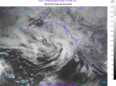
Let me show you a sequence of visible satellite images from the NWS GOES-West geostationary satellite, orbiting approximately 35,000 km above the planet. Below you will see a series of these images, starting 3 PM (2200 Z--zulu time or GMT)-- before any lunar shadow was evident.  Note the area of darkness--the lunar shadow-- that moves in starting 4 PM (2300 Z).  The dark splotch approaches and crosses the West Coast. By the last image (7:30 PM), most of the darkness has cleared the western U.S.  Scroll down quickly to get the effect.


Pretty neat. If you want to see a satellite loop...check this.

One place in western Washington that did get partial view was in Sequim, where the downsloping flow thinned the clouds (the ensemble prediction in the previous blog suggested this).  Here is a view by Seattle PI photographer Joshua Trujillo (his article found here).

Sequim View by Joshua Trujillo
Those folks in rain-shadowed Sequim have it too good.  But their water bills must be horrific.

 If you want to see more views from  the ground there a number of videos on youtube .   A sample: http://www.youtube.com/watch?v=uFcwAPFMM-k


Support : Creating Website | Johny Template | Mas Template
Copyright © 2011. The Weather - All Rights Reserved
Template Created by Creating Website Published by Mas Template
Proudly powered by Blogger