Interesting Differences in Local Snow

| comments

Today there were dramatic differences of snow--even within the City of Seattle--that illustrate some of the challenges of forecasting around here.

Some of you in Ballard and northwest Seattle complained that you hardly saw much snow , while luck denizens of Capitol Hill, perhaps 5-6 miles away, got 3-4 inches in places.  Here are a few pictures from Capitol Hill, courtesy of Joseph Chan, a UW undergrad (taken around 2:20 PM).


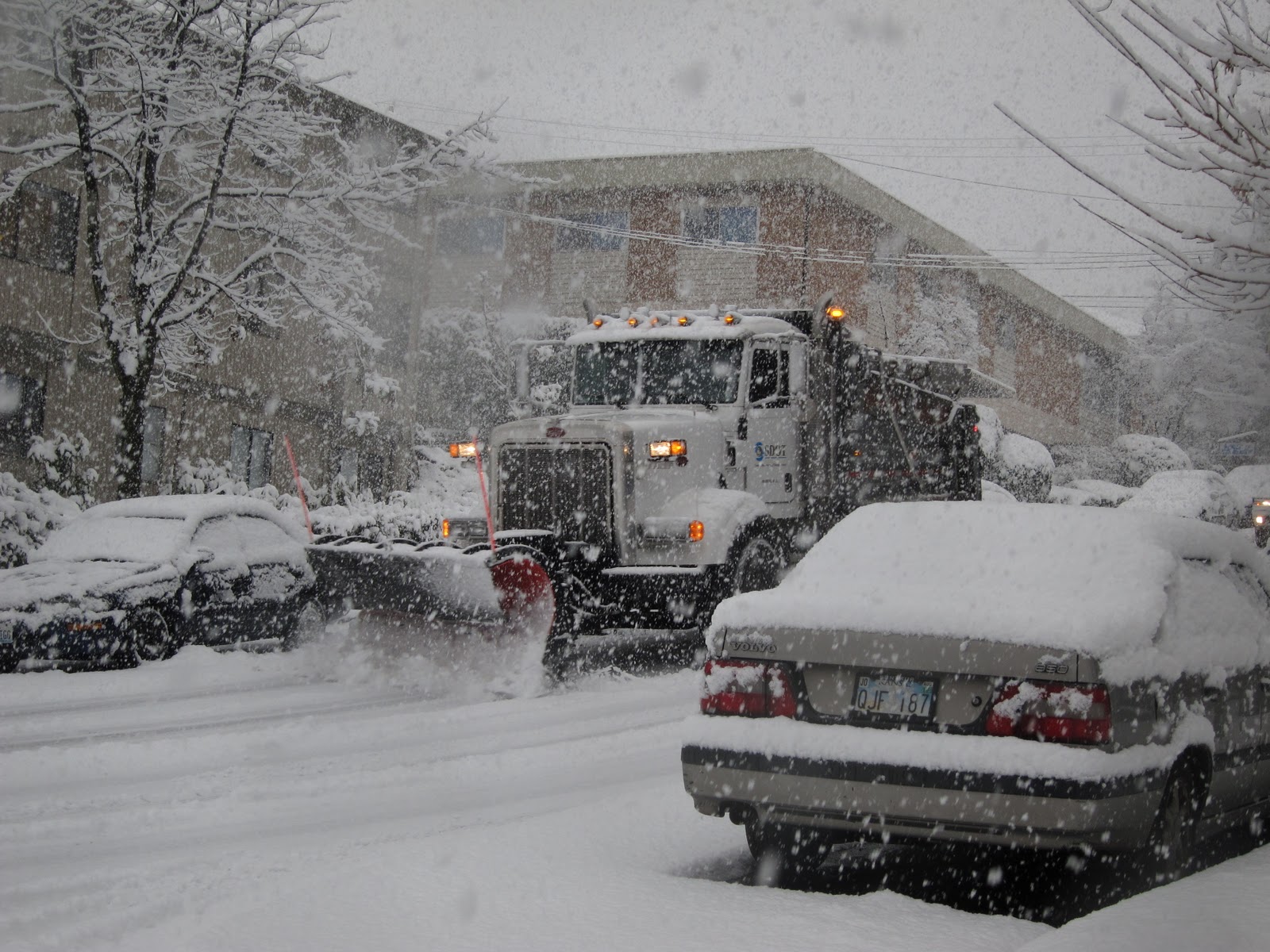
You notice the Seattle DOT plow on the job!   A lot of snow.

It turns out there was a band of heavy precipitation--oriented southwest to northeast- that remained quasi-stationary and crossed the southern part of the City.   Here is a radar image at  2:32 PM...see the band?

And here is the estimated 6-h snowfall ending 4: 37 PM from our new SnowWatch application:
As I mentioned earlier, a low pressure area moved down the coast.  Then this low moved eastward south of us.  During a period in the early afternoon we had a situation with southerlies moving up the southern Sound from this low and other air moving southward towards towards the low from the north.  These airflows converged together---like an alternative convergence zone--and caused air to rise...giving us the enhanced snow.  Don't believe me?  Check out the winds at noon.  Notice the winds from the ferry runs in the north and south Sound are in opposite directions.   And there was a reversal of the winds aloft.
 Enough fun.  Some serious weather ahead.  Snow will pick up substantially tomorrow afternoon as another upper trough approaches---many will get several more inches on Monday and Tuesday.  Here is the 24-h snowfall forecast ending 4 PM on Monday and Tuesday, to illustrate.  There will be more Olympic Mt. snowshadowing in the central Sound for this event since the flow is forecast to be more westerely.  Of course, this is not cast in concrete and the exact distribution of snow has considerable uncertainty.


Big snow dump in the mountains during the second period!   But the bigger story is what happens on Wednesday as a strong warm front approaches.  

Dare I show it to you?

Here is the 24-h snowfall ending 4 PM on Wednesday.   More inches...and most of that falls in the lowlands in the morning...before temperature surges and it starts to rain.
SLUSHMAGEDDON A vision that should scare any mayor.  And one I am sure will put a smile on the face of KING-TV's Jim Forman.  If the warm/low goes farther south than forecast there could be much more snow.   Wednesday has the potential to be a very major snow event, but the uncertainty is still large....more tomorrow.


Share this article :
 
Support : Creating Website | Johny Template | Mas Template
Copyright © 2011. The Weather - All Rights Reserved
Template Created by Creating Website Published by Mas Template
Proudly powered by Blogger