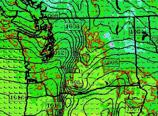
 |
| 7 AM |
 |
| 7 PM |
The winds were very variable and intermittent...some places got hit by strong gusts for a while and later experienced light winds. Here are the winds today at a high (6730 ft) east-slope location--Mission Ridge:
Some mighty good windchill up there! In contrast, winds at Ellensburg were only gusting into the 30s (knots)
Now to understand these winds one must begin by noting we have had a VERY powerful jetstream over the Pacific that has headed right into us from the northwest.
Here is the upper level chart at 300 hPa (around 31,000 ft) at 4 PM Sunday.. Some winds are well over 150 knots, with some reaching 190 kt (219 mph!!). Don't try to fly to Asia...it will take forever.
 |
| Winds indicate by dashed lines and barbs. |
And the interaction of the strong flow with the mountains can produce mountain waves that can bring down the momentum from aloft and enhance wind speed. Here is an east-west vertical cross section across the Cascade today and you can see this effect (shading indicates wind speeds--dark red is strong, and air flow tends to follow the solid lines):
Lets take a look at the wind gust prediction at the surface (really 10 meters) from the high resolution WRF model today at 4 PM. The first is from the 4-km grid spacing domain and the second is from our ultra-resolution 4/3 km domain. Lots of gusts over 50 kts in the high-resolution domain.
Hate to say it...but there will be plenty more of this over the next few days.


