
But first a recap to make you feel better. Here are the temperatures at Sea-Tac Airport versus the normal high (red line) and normal low (blue) line for the past two weeks.

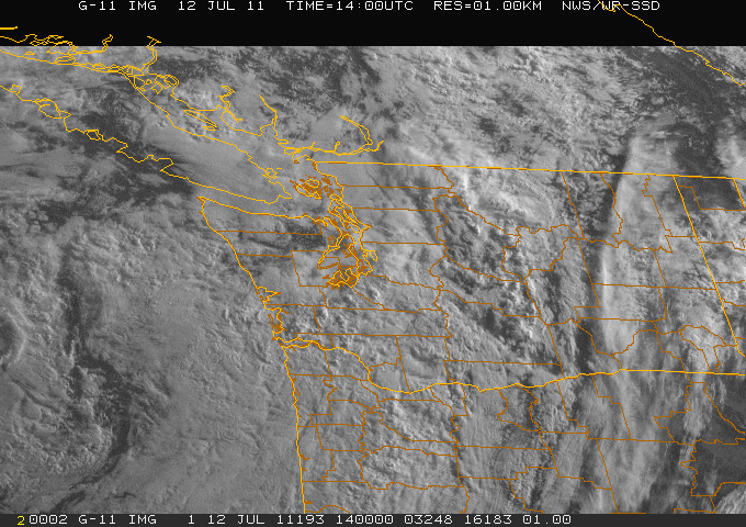
But something has changed--something that is obvious by scanning the sky. Yesterday some showers moved through and today (Tuesday) we are certain to get more. Here is the latest visible satellite picture. It looks like winter, with clouds over the entire region and a very solid mass of clouds moving in from the southeast.
Why is this happening during a period in which the weather is usually fine? The reason: an anomalous upper level low has moved in just offshore. Here is the upper level chart for this morning for the UW WRF forecasting system:

The chart shows the height of the 500 mb pressure surface (roughly 18000 ft) and you can see a deep low centered a few hundred miles off of Washington. And upper level troughing just hangs out along the West Coast this week. Here is Wednesday afternoon:

Saturday during the day:

And Sunday late afternoon

You get the picture...this pattern is not going anywhere according to this forecast model solution. Last night's run had a major warm up on Monday...no longer.
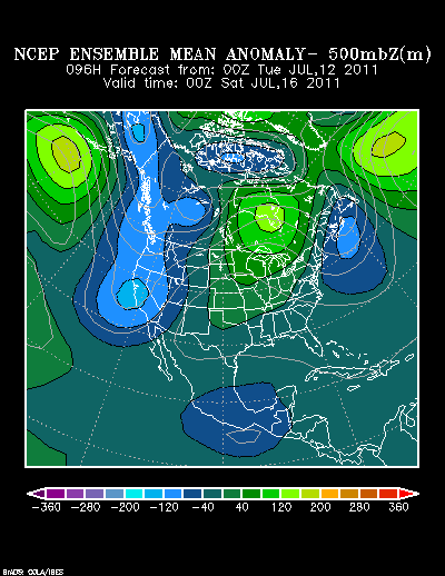
One tool meteorologists use to estimate our confidence in theforecasts is from ensembles--running the models many times with slightly different starting points or physics. The average or mean of the ensembles tends to be more skillful than any individual forecast and spread of the forecasts give you a measure of uncertainty.
Here is the ensemble-mean anomaly (difference from normal) for upper level heights (same field as above) from the National Weather Service operational ensemble system. Blue indicates that the mean of the ensemble is lower than normal and there is a lot of blue along the west coast. And we are not talking just about the Northwest--the entire West Coast will be cooler and cloudier than normal.

And the spread or variation among the ensembles is relatively low (see graphic below)--thus the confidence in this cool solution is relatively high.

The ensembles do have a lot of disagreements next week---so don't sell your swim trunks yet. But in the near term, don't plan on typical warm, sunny weather. And keep in mind this upper level pattern is making the eastern U.S. unbearably warm...with upper 90s in New York today.


