
 |
| Approaching strong cold front over the central U.S. |
On the other hand, frontal passage is far more fun along the coast and the offshore waters: big windshifts with strong winds, are not uncommon. But even there temperature changes are minor.
So why do our fronts have such weak temperature changes, unlike their eastern brethren?
Answer: The Pacific. Fronts moving off of Asia and Alaska might start with large temperature contrasts across them, but the relatively warm waters of the Pacific warm the cold air over time, so by the time the fronts reach us, the temperature differences are well, wimpy. In fact, cold, dense air moving over warm water is very unstable and you get lines of cumulus called cloud streets. Below is a satellite picture of the process. Such instability is a very effective mixing machine. Often there are large temperature contrasts across fronts at say 5000 ft than at the surface.
 |
| Cold air pouring out of Asia and Alaska produce lines of instability clouds. |
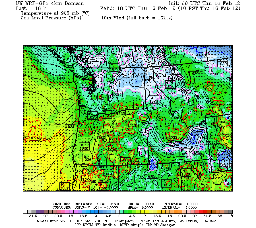
But there is something else...our mountains. Terrain tear fronts apart at low levels, and mountain effects greatly perturb the wind and pressure fields associated with fronts. We can see this today!. Here is a simulation of the front that came in this morning. The first image shows the front offshore--nice pressure trough and wind shift. The second shows the situation after landfall....can you see the front?


So we live in the land of weak fronts...
The next few days we will see a relatively strong low center move through, but by the end of the weekend another major ridge will develop in the eastern Pacific. The mountains will get some snow, which is good, but it is looking increasingly unlikely that we will see lowland snow for the remainder of this winter.
The draft agenda of the Northwest Weather Workshop is now online at:
http://www.atmos.washington.edu/pnww/index2012.php?page=agenda
and the general meeting page is at:
http://www.atmos.washington.edu/pnww/
http://www.atmos.washington.edu/pnww/index2012.php?page=agenda
and the general meeting page is at:
http://www.atmos.washington.edu/pnww/


