
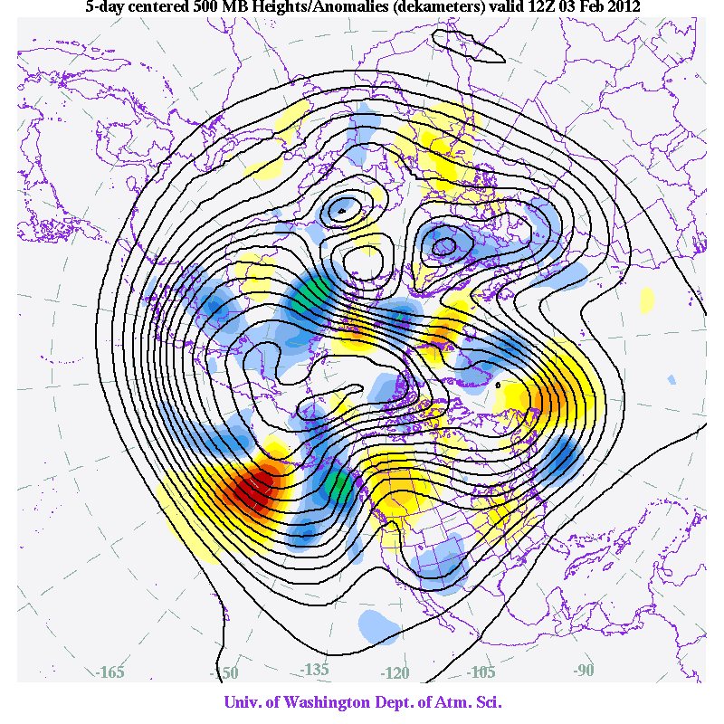
To see what is really going on it is useful to view a 5-day running average of the upper level charts. Such an approach removes some of the transient, high-frequency disturbances so one can view the underlying, slower-changing, atmospheric circulation. Let me show you such charts, starting a week ago and going forward a week...you will see a ridge over us--varying in strength for sure---but a ridge nevertheless. The shading shows you the differences between the upper level flow (500 hPa--roughly 18,000 ft above the surface) at that time and the 5-day average (anomalies)--but you need not be concerned with them for this discussion. Here they are--the ridge (the height lines deflected to the north over us-- just doesn't go away!


The most skillful long-term guidance is that of the European Center ensembles. Here is the ensemble forecast (left panel) and their single superhigh resolution prediction (right panel) for next Thursday......same story....the ridge, albeit a modest one.

With ridging we will see less storminess, intermittent light rain at most, no snowstorms--pretty benign pattern. I see this pattern next weekend, I am going to start preparing my vegetable garden...spring planting time will be here for the early start plants. And the city of Seattle DOT folks will be able to relax.
Northwest Weather Workshop. This is major local meeting for weather professionals and enthusiasts. All are welcome. March 2-3 in Seattle. Info here on the meeting and registration. The banquet speaker on Friday night will be Andy Wappler of Puget Sound Energy.


