
First piece of evidence: the below normal temperature and above normal precipitation of the past 1-2 weeks (see graphic of temperatures at Seattle Tacoma Airport compared to average high and low). For the past ten days the maximum temperature has remained well below normal.
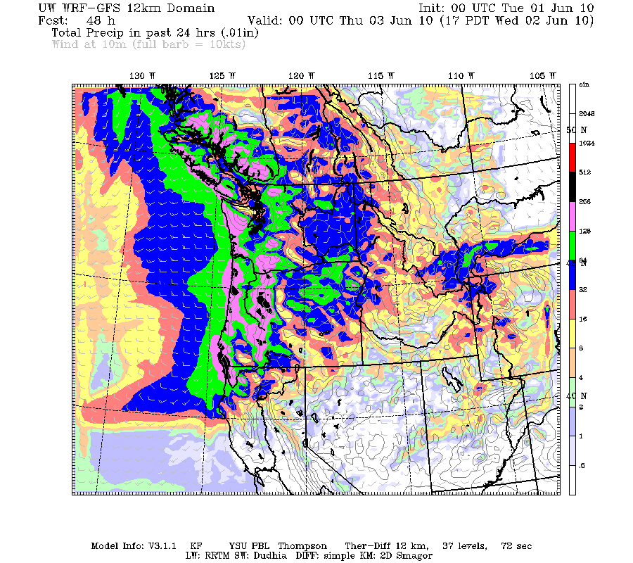
 But what is remarkable, is that this run of cold and damp is not going to end soon.
Tomorrow will be decent, with partly cloudy skies and few scattered showers. But Tuesday night and Wednesday a strong wet system will cross the area. Take a look at the forecast 24-h precipitation ending 5 PM Wednesday.
Thursday is a break day and then an REALLY strong system hits on Friday...and may be a powerful windstorm on top of rain. Here is the latest (Tuesday noon) output from the UW high-resolution forecast model for 5 AM Friday. A 990 mb low center right off our coast, with strong coastal pressure gradients. I also have the forecast winds--40 kt sustained along the Oregon and southern WA coasts! This is intense weather for June.


Want some good news?...no major weather feature over the weekend.


