 The last few days have been roughly 10F below the normal maximum (which is around 65F).
 My tomatoes are fading.
The windstorm was of course not the usual May fare. Why so cool and showery? The reason is that a broad upper level trough or low, with associated cold air aloft, that has been parked over the western U.S. (image below). This same pattern is producing a heat wave over the eastern U.S.
 And I don't have particularly good news for you..there is no real warmth in sight and another cold trough is headed our way!
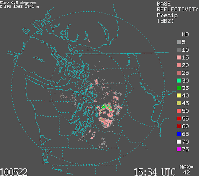
Today's situation is made clear by the latest visible satellite photo (below). Sunny east of the Cascades (an excellent place to go during cool spring periods). The influx of cool, moist air has produced clouds and light showers on the western side of the Cascades and the crest, and westerly flow is producing a weak Puget Sound convergence zone, something evident in the latest radar image (below). Cool, unstable air is approaching from off the Pacific. So outside of the convergence zone Saturday will be partially sunny, cool day with highs in the upper 50s.

 The convergence zone and showers should rev up later today and tonight (see forecast precipitation below), and more clouds and showers are expected Sunday.
Monday should be the best day as the upper trough moves out.
 But THEN another cold upper level trough moves in mid-week (see upper level map for Wednesday)...and you know what that means....
