
Here in the Northwest we are experiencing wetter and colder than normal conditions on most days, with some locations shivering under daily low temperature records. Yesterday, temperatures plummeted to 37 at Shelton, 39 in Olympia, and 38 at Yakima. In some cold hollows near the surface temperatures may have dropped close to freezing. In late June.
At the same time, temperatures in Colorado have reached over 100F day after day, some all-time high temperature records have been reached, extreme drought is in place, and fires are descending the Front Range of the Rockies into populated areas.
Let me illustrate....here are places that have experienced record low temperatures across the U.S. yesterday--some over the southeast U.S. associated with a trough and clouds and the other over guess
where....

In contrast, here are where the high maximum temperature records occurred--from Wyoming through, Colorado, Oklahoma, to Louisiana on the same day.

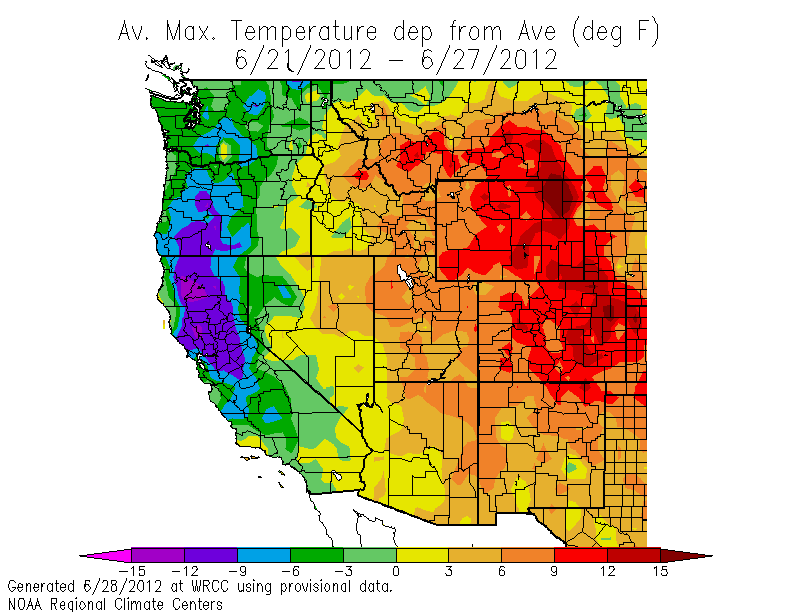
These extraordinary warm anomalies are occurring in locations where precipitation has been nearly absent all spring. Here are the precipitation anomalies for the last month...large areas have had 5% or less of normal precipitation. No wonder wildfires started so early. And yes, WE have had wet anomalies...with eastern Washington being particularly wet. I wonder what that implies for agricultural interests there.

The reason for all this contrasting weather is due to a highly persistent atmospheric flow pattern with a stubborn trough over the eastern Pacific and a big ridge over the Rockies and middle part of the country. Here is the mean upper level (500 hPa) flow and the anomaly from climatology. You can see the troughs on both coasts and the big ridge over the middle of the U.S. The trough off our coast represents a very large anomaly from normal, if that makes you feel better

But I know what you really want to know, how does July 4th look? Will this abysmal pattern ruin our fireworks and barbecues? Here is the answer from the latest European Center model run. The panel on the right is the average of their ensemble (many model run) system and one on the right is their best single prediction, both for the upper level flow (500hPa). The SAME pattern is there-troughs over the coast, big ridge over the central U.S.

At least we won't have to worry about wildfires, air conditioning, or firework cancellations. Just mold and mildew.


