
 During this time of the year the atmospheric structure of the eastern Pacific is often characterized by a relatively shallow moist layer, with dry air overhead. Want to see a sample of this? Here is the sounding of temperature, wind, and dewpoint at Forks on the WA coast. Such soundings are produced by launching radiosondes--instrumented weather balloons. Remember when the temperature (red line) and the dewpoint (blue line) are close together, the air is saturated (100% relative humidity). The height is in pressure (1000 mb is near sea level, 900 mb is around 3000 ft). Temperature is in centigrade.
 You see that the low-level air is moist and saturated in the lower few thousand feet and very dry aloft. In fact, capping the moist layer there is a very stable layer--an inversion where temperature increases with height. Want to know why we are so persistently cloudy during late spring and early summer?---blame that moist layer and inversion!
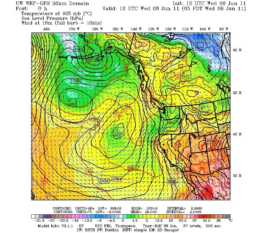
Now why do we get this infernal atmospheric structure? Ironically, it is due to high pressure over the eastern Pacific this time of the year! Here is the pressure pattern this morning (Wednesday) at 5 AM. You see the big high?
 That is the culprit. High pressure areas produce sinking motion, particularly on their eastern sides. The sinking decreases towards the surface (since air can't do through it). Sinking produces warming. Thus, there is more warming aloft. That produces a an inversion or stable layer! Think of it this way....warm, less dense air, with cold denser air below does not like to mix, since the cold air is heavier. With a stable atmosphere there is not a lot of mixing, so the lowest portion of the atmosphere in contact with the ocean get moister and moister...and you can imagine what that produces....low clouds.
So high pressure gives us June gloom, Juneuary, or tomato hell...whatever your favorite terms for this dismal situation is. But you can escape it! The marine air is shallow and doesn't get across the Cascades...so head over the pass and you can enjoy sun and warmth...that is what I did last week when I went mountain-biking near Thorp with a friend.
But take a look at that satellite image again..you see the really clear area over the northern CA coast? What causes that? Any meteorologist worth his/her salt knows---offshore flow. If you look at the surface map above (which also has low level winds, click to make big) you will note the pressure lines (isobars) and winds suggest an offshore component of the wind across northern CA...those offshore winds are driving warm, dry continental air over the ocean, producing the clearing.
It looks like we are going into a period of absolutely boring weather. A lot of days with low clouds in the morning, some sunbreaks, temperatures near or bit below normal in general. But no tornadoes, windstorms, wildfires, flooding, or anything that will distract us from complaining about the low clouds. And you may have to start watering your garden.
Other news:
I will try another videopodcast Friday morning to replace my KUOW segment.
I left a detailed commentary about the KUOW situation at:
http://www.facebook.com/pages/Put-Cliff-Mass-back-on-KUOW/149155005153152
And PLEASE, will someone run for the district one Seattle School Board position against Peter Maier! Many of us really are hoping that we can turn the Seattle school district around, but we have to replace a few of the poor members that allowed things to get so bad.


