

It is become increasingly clear that our offshore waters will be hit by a very powerful low pressure center (what we call and extratropical cyclone in the business). The result will be hurricane-force gusts over the eastern Pacific and 30-40 ft waves striking our coastline. The interior should be generally spared with one exception: Northwest Washington and the Strait of Georgia, which will get 20-45 kt winds.
In reality there will be three major weather events:
The first is the weak system moving through right now....a bit of rain and windy offshore, but nothing major.
The second is a stronger, somewhat wetter system on Saturday morning.
But the real McCoy is on Sunday morning--a deep low offshore, with a very wet front moving through Sunday morning.
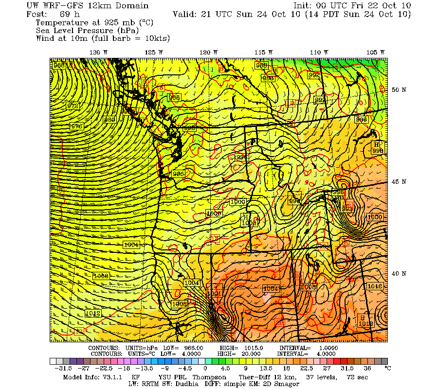
Lets cut to the chase. Here is surface charts for Sunday at 2 PM:

This is a 961 mb low..quite deep. However, the last few runs have taken it farther offshore--which makes it less of a threat for western Washington and Oregon. Here is a closer in view at the same time. Lots of isobars (lines of constant pressure), which results in strong winds offshore.
Here are the model surface (10 meter above the surface) winds at the same time. Offshore there are sustained winds of 45 knots and the gusts would be much stronger.
 Actually, the strongest winds on the coast will be late on Saturday, when the associated occluded front moves in (see figure). Sustained winds on the coast could hit 45 knots with higher gusts. Great weather for storm watching.!
 These strong offshore winds will raise the sea and wave reaching 30-40 ft will move towards the coast. Here is the output from the NOAA Wavewatch III model, which predicts wave heights using the forcing from the atmopsheric models.
 If this storm was a few hundred miles east of its predicted position we would be talking about a major damaging even and the weather channel would be flying in one of their storm folks....but fortunately that won't happen (if the models are right). I should note a rule of thumb of local meteorologists: to get strong winds over Puget Sound and the southern interior the low pressure center must cross the coast south of central Vancouver Island (my book has more on this).
Want to see the storms lined up on the satellite imagery? The first frontal band is on us. The comma-shaped system offshore is Saturday morning, and the huge, pregnant cloud mass farther offshore..THAT is the big one.


