
UPDATE SAT MORNING: HOT!!
Going to be warm today! Lots of places will be in the lower to mid 90s! Clouds have made their way up the Oregon coast...so go there for cool.
 Click on picture for closer view
Going to be warm today! Lots of places will be in the lower to mid 90s! Clouds have made their way up the Oregon coast...so go there for cool.
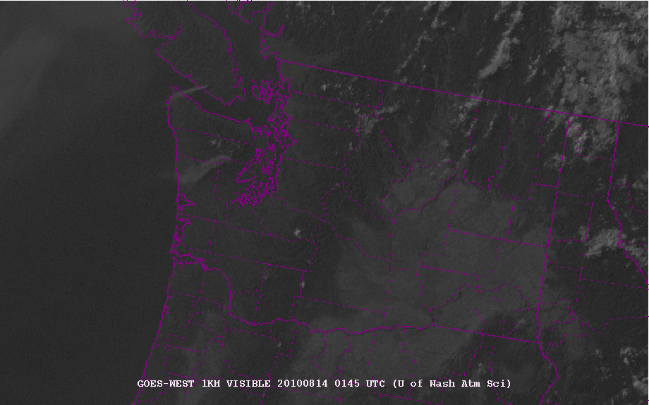
 Click on picture for closer view
Above is a NASA MODIS image from this afternoon...something has changed! No low clouds on the coast! The unimaginable has happened. And heat and clear skies will dominate for a while due to offshore (easterly flow). These pictures are really wonderful, with superb resolution. You can see the irrigated lands of eastern Washington and cumulus forming over ridges over the northeast and eastern mountains. You can also see smoke from the BC fires lurking offshore (don't worry, the easterly flow will keep it at bay). Interestingly, all that irrigated land in eastern Washington and elsewhere (like the interior valley of CA) act to cool the surface down by 1-5F. Not enough area to neutralize global warming through.
Unfortunately, the warm easterly winds have helped stoke two new fires...one on the Olympic Peninsula and the other on southern Vancouver Is. Check out this evening visible satellite picture...you can see smoke plumes from both.
Here is the latest forecast for tomorrow at 5 PM..near the time of warmest temps...upper 80s and lower 90s over the lowlands, INCLUDING the coast. Those coastal folks are in for a shock...perhaps a welcome one. Surprising, it may be warmer west of the Cascades than on the eastern side.
 Two interesting facts..here in Seattle it is 11F warmer tonight than yesterday at the same time. Second, the dew points are relatively low (50-55F) so the humidity is comfortable.


