

It is really looking like we will FINALLY see some real warmth this weekend...but first there will be clouds and rain.
As an amusing aside, it looks certain that we will break a major record tomorrow...the latest in the season that the Sea-Tac maximum temperature has not hit 75F! The record is June 9...and there is virtually no chance we will get that high tomorrow. You will tell your grand kids about this some day. Maybe.
A front with some heavy showers is moving in now (Tuesday night) and more are expected Wednesday and Thursday. Friday is the transition day and then the unexpected will occur....ridging aloft and offshore flow leading to a major warming on Saturday.
Exhibit 1: Here is the 500 mb upper level chart for Friday at 4 PM. A very nice ridge is developing.

Exhibit 2: The same chart a day later...even better.
 What about the surface temperatures? Here is the latest model forecast for 5 PM on Saturday. SEVENTIES OVER THE LOWLANDS. And 80s in the Willamette Valley and portions of eastern Washington.
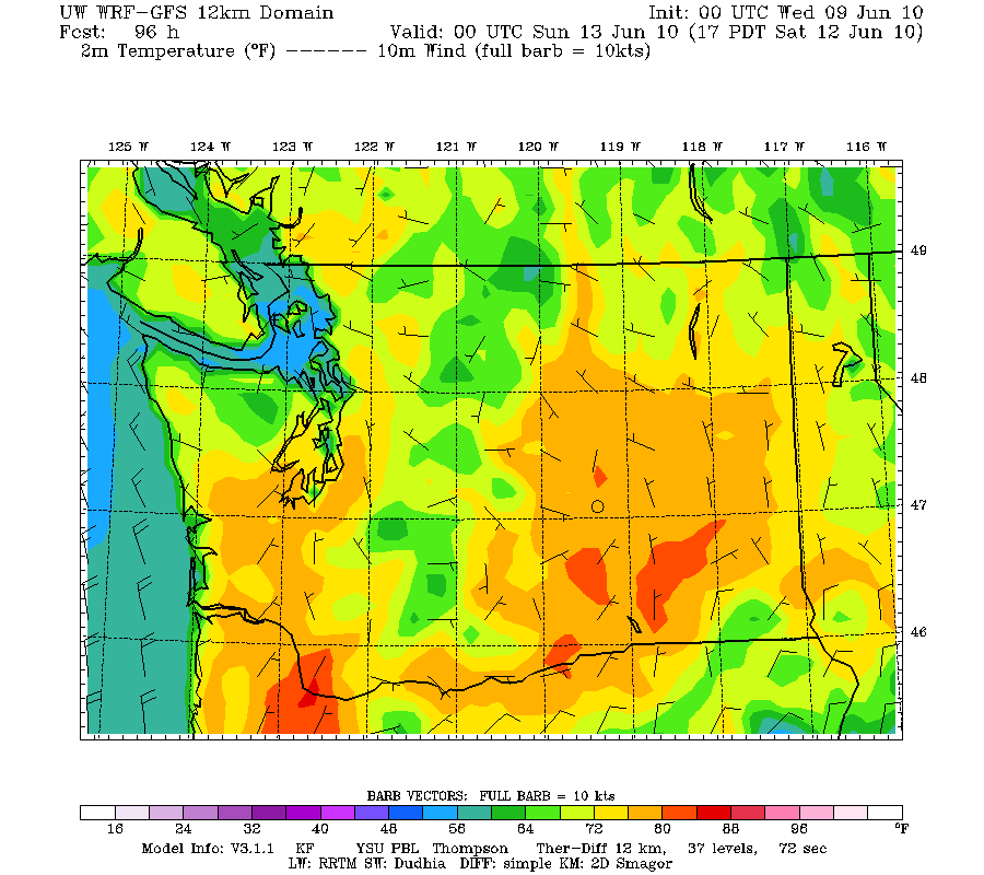
Get your barbecues ready! The ridge will hold through Sunday, with temperatures at least as warm. Unfortunately, it will cool down in next week a bit...


