

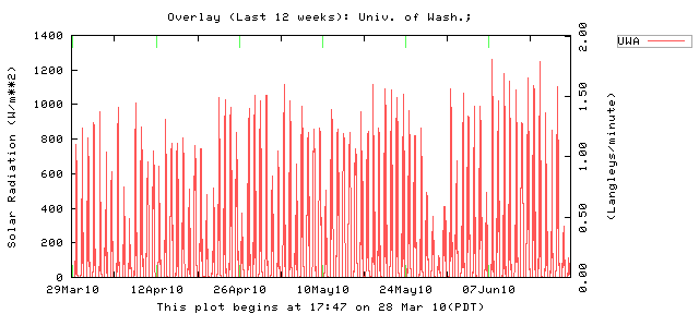
We are about to repeat an age-old Northwest weather pattern. People complain about the "unusually" cool and cloudy June. The weather prediction for July 4th calls for clouds and a chance of showers, and somehow the fireworks just squeak bye on a cool, but acceptable night. And then the miracle occurs. Like a switch being flipped, our weather warms dramatically. The lawns turn brown and watering our vegetables and plants is mandatory. The best weather in the nation takes hold for roughly 2-3 months.
And it is about to happen again.
For the past weeks a persistent trough of low pressure has bedeviled the Northwest, bringing cooler and cloudier than normal conditions. But lets get one thing straight--June is typically NOT a good month west of the Cascades. Normal is lots of low clouds and hit and miss sunshine.
But as they say it is darkest before the dawn....and tomorrow will not be pleasant. A fairly strong upper level trough is now approaching (see figure) and it is associated
 with considerable clouds and showers (see satellite picture). Tomorrow (Thursday) will not be nice. Lower 60sF.
A second weak trough comes through early Friday, leaving that day with scattered showers and a few sun breaks. Perhaps mid-60s
Saturday really should be decent, with little or no precipitation, partly cloudy skies and considerable sun and temperatures in the mid to upper 60s.
On Sunday, July 4th, the air will still be on the cool side and there will be lots of onshore flow; there could be some light, scattered precipitation, strengthened by a weak disturbance moving to our north early in the day. No guarantees. But no major storm.
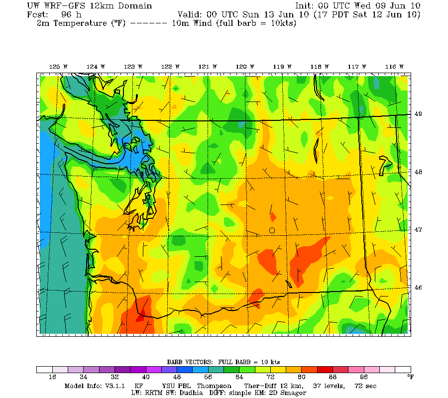
But then the impossible will occur. Ridging in the eastern Pacific will build.
The pesky west coast trough will be no more and temperatures will warm rapidly on Monday and Tuesday.
Sun will return and temperatures will reach the seventies from Tuesday onward. Here is the upper level flow for Tuesday afternoon...a magnificent ridge.
 Even lower to mid- 80s away from the water by mid-week. We are talking a significant heat wave and it will seem more so with all the cool weather we have been through.
Time to purchase a fan....
Finally, if any of you are interested, I will be one of the instructors this summer (August 5-8) at the North Cascade Institute's Northwest Naturalists Weekend: Weather, Wildfire and Biodiversity. I will provide a series of talks on NW weather and the other instructors will be talking about effects of wildfires and about lowland forests. Plus, hikes and canoe trips and good organic food in a beautiful location. For more information go to:
http://www.ncascades.org/programs/seminars/course.html?workshop_id=1018


