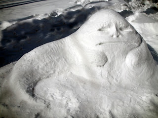
Last winter we were securely in La Nina conditions and the region experienced a miserable, cold, wet spring that lasted into mid summer. Horror to all soccer and Little League parents.
This winter we have also been in a La Nina and since early February we have been colder and wetter than normal, with snowpack surging in our mountains.
Yes, it appears we are dealing with the revenge of La Nina.
 |
| Beware the white side of the force |
Here is the plot of temperatures at Sea Tac versus normal highs and lows for the past month. Only four days have equaled or exceeded normal, while a large number of days have been below normal.
Here is the departure of temperature from normal for the past 30 days: the western U.S. has generally been colder than normal (dark green and blue), with western WA and Oregon, MUCH cooler than normal. Maddeningly, nearly all of the nation east of the Rockies had been much WARMER than normal.
Precipitation has been greater than normal over the Cascades and western WA, resulting in a rapid build up of snowpack. As you can see from the snow water equivalent on March 15th, much of our area is above normal. But CA is still in a snow drought.
Between the 9th and 14th of March, Mt. Baker added 59 inches of snow and now is virtually tied with last year's total on the same date (251 inches on the ground today, 252 inches a year ago). Take a look at the snow water for the Seattle watershed (Cedar/Tolt)--way above last year and normal. We are already well above the normal winter max snowpack at that site.
The fascinating thing about La Nina years is how often we have seen this late winter surge of snow, cold, and precipitation. You never give up in February...March is often a big snow month.
So what is going to happen? Are we going to have to endure a non-spring like last year?
There is some suggestion that our fate is different than last year...we will suffer...but the wet, chill will not last into summer.
First, the suffering. The last extended runs of the best modeling system in the world (the European Center), indicates that upper troughing with cold, wet weather will last for at least the next ten days. In fact, we will get quite cool this weekend, with a chance of lowland snow in the Puget Sound convergence zone on Saturday morning (but nothing heavy) and low snow levels (roughly 500 ft) ocer the weekend. That means higher hills could see some flakes....but no real accumulations until you get to 1000 ft. Continued snow in the mountains.
But something is changing: La Nina is rapidly weakening. As shown in the next picture, the cold anomalies in the central tropical Pacific are rapidly declining and some parts of the tropical eastern Pacific are now warmer than normal. Predictive models suggest that La Nina will be over by the end of April.
As explained in previous blogs, La Nina often forces ridging in the eastern Pacific and troughing over the NW--producing the cold/wet pattern. By early summer the La Nina forcing should be over.
The NWS runs a climate prediction system four times a day that predicts the weather out several months. Here is what it is showing for temperature. A bit colder than normal for early Spring, followed by near-normal temperatures for late spring into summer. Maybe, just maybe, we will get out this infernal pattern.
I am buying my tomato seeds this week!
 |
| Jabba the snowman is not happy. |


