Let me begin by noting it is true, we rarely get tornadoes and severe convection, but rarely is not never. Here is an example of one that hit near Monroe:
The annual average number of tornadoes around the U.S. is shown below. We may be tops in airplane and system software production, but we are in the junior leagues for tornadoes: average of one per year in Oregon and Washington

If you look at the frequency of severe thunderstorms you can see a similar pattern (see below-darker reds to brown mean more severe thunderstorms). Coastal Oregon and Washington have the least and Oklahoma and adjacent plains are pummeled. It turns out the high plains of the U.S. get more severe thunderstorms than any place on earth.
 So why are we in the bush league when it comes to tornadoes and heavy duty convection. Well, the key reason is that we don't get many thunderstorms and our thunderstorms are wimpy! Look at this map below-- the West Coast has roughly ten a year while the Great Plains and Southeast can experience 60-100 a year. Tampa gets more than anywhere else in the U.S.
 The reason for this pattern is the cold Pacific ocean and warm Gulf of Mexico. Thunderstorms like two things: lots of moisture in the air and big change of temperature with height--normally from a warm surface. Well, the Pacific is COLD, even in the summer (50F about tops it out), and cold water cannot put much water vapor into the atmosphere and keeps the surface cold. BAD FOR THUNDERSTORMS! And we get thunderstorms that are generally pretty pathetic. If ours get to 15,000 feet it is cause for wonder, in the Midwest 50-60,000 ft is not unusual.
Why so vigorous in the eastern portion of the country? Warm water, with the summertime Gulf of Mexico getting into the 80s and higher, pushing huge amounts of water vapor into the atmosphere, and keeping the lower atmosphere nice and warm.
And there are other reasons why Oklahoma and vicinity gets the strongest storms on planet---there is often strong wind shear (southerlies at low levels and westerlies aloft) there , which really helps the storms strengthen, and dry air aloft coming from the Rockies and Mexican plateau. Turns out dry air over very moist air helps support convection.
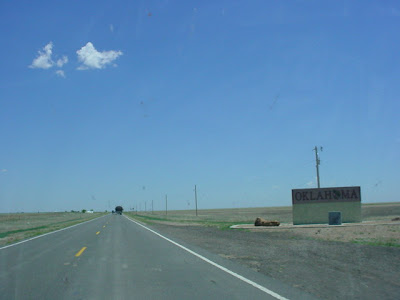
So if you want to study severe convection, don't come to the UW...head to the University of Oklahoma, and the barbecue is better there too. And you won't have much hiking or skiing or boating to distract you from your studies (see typical OK picture below). And there are basketball team rustlers there.
 But if you love orographic precipitation or huge cyclones with powerful winds, you can't do better than here. And much better salmon.
Finally, let me remind you about the NW Weather Workshop on May 13-14th. You need to register for this if you want to go. Details on the right.
And one more announcement:
Sustainable Seattle will be hosting a symposium about the effects of climate change on the Pacific Northwest's rivers, glaciers, snowpacks and shorelines, and the impact of all this on our infrastructure and communities. The event will be on May 12 in Magnuson Park, featuring a range of speakers from government, academia and the private sector. See http://sustainableseattle.org/training/246 for more details, including the full list of speakers and online registration.


