

Update: 1:30 pm...It really appears that some kind of haze/smoke layer is over western WA...with yellow/orange/red coloration of the sun and sky. From the eastern wa and British Columbia fires? In fact, checking on the situation, I think the overwhelming proportion of the smoke is from the many fires in British Columbia. In fact, here is a graphic for vertically integrated smoke for 10 PM from the National Weather Service. It really appears the origin is in BC.
 The MODIS picture today really shows the smoke over us (see picture above).
Here is wonderful video of the smoke (http://www.drdale.com/lapse/lapse100801.wmv).
Normally I show pictures from the National Weather Service geostationary weather satellites, stationed at around 35,000 km above the surface...that is what you normally see on TV and on the web. But sometimes I turn to the NASA MODIS imagery, which provides much more resolution, but which is only available a few times a day.
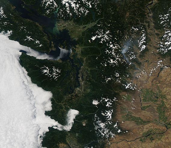
 Above is an example from yesterday. See the low clouds over western Washington--but now you can note the details. You can also view the lines of convection...thunderstorms...on the eastern slopes of the Cascades and the relatively clear skies over the crest and western slopes (where I was hiking yesterday!)
Here are some MODIS images the day before...you can see the Stehekin fire very well...particularly in the close up.
 What about today (Sunday). Here is the latest visible image (not MODIS). Lots of clouds in the west, but with a few breaks around Centralia. Looks like some kind of smoke layer over the west...could the smoke from some of the fires have made it over the Cascades and from British Columbia?
 The marine layer is deeper this morning, even pushing up to the pass (see image)
 Expect a slow burn-out this afternoon. I wish I could tell you I expect a major change in the situation, but I don't. We are locked in this pattern, with no change in sight.
Now, let me answer a question that has come up time and time again. For many cyclists in the Seattle area that live north of the city, they face headwinds in the morning and headwinds in the evening. How could this be?
The reason: the winds are often near calm in the morning, or in the situation we are in, southerly. During the day the clouds break and the land heats up. This creates a big sea breeze circulation, known as the Sound Breeze, that brings northerly flow during the afternoon (more water to the north of Seattle than south). My book has a lot more about this.
A message for boaters:
Please help researchers evaluate how to communicate weather forecast information.
The survey will take you only 20 minutes to complete.
Survey data will be used to improve weather forecast products designed for boaters.
If you own a boat and would like to participate, please click on the link below. Thank you.


