Napavine Tornado

| comments

NOTE: Will be trying the videopodcast tomorrow (Friday) morning again. Hopefully will be a bit smoother!...cliff

Today the NWS released a statement confirming that an EF0 tornado (the weakest kind) hit about a mile east of Napavine, a small town in SW WA near I5 around 2 PM (2100 UTC) on Friday (see map):

The tornado touched the ground for a few hundred feet, damaging a barn, some fences and a few trees.


Here is a video of the scene:


Curious, the first thing I did was to check out the radar image (below). You can see a very strong line of convection...yellow indicates a real downpour.


But what about rotation? Any sign in the radar Doppler velocities (which they NEVER show on TV)? The colors in the image below for 2 PM indicate velocity towards or away from the radar (which in this case is just west of Portland). Rotation is shown by a couplet of warm and cold colors, warm colors (e.g., yellow) indicating flow moving away from the radar and cold colors (e.g., green) towards the radar). No sign of a velocity couplet.

This suggests a weak, non-supercell tornado. There can be some weak rotation near the surface (perhaps from air passing around a small terrain barrier) and the rotation gets "spun up" by the updraft of the convection. Sort of like a skater spinning up when she pulls her arms in (this is really based on the conservation of angular momentum).

Typically Washington gets a few tornadoes a year and few of them are very damaging. The worst we have ever had was the EF3 Vancouver tornado in 1972.

KUOW Situation

Still waiting on them after I asked them to work with me on some type of compromise. Today their board chair put out a statement saying I decided to quit (not true) and that it was also the decision of the program manager, Jeff Hansen. Just gets stranger and stranger.

I think I was the only regular they had down there that was not allowed to speak on a variety of topics. Even stranger, I have talked to a number of other radio stations and NONE of them have said anything about constraining my speech. In fact, one news director laughed and said he WANTED me to talk about education topics--it would lend interest to the program. Why is KUOW different? Why is speech most constrained on a public radio station owned by the University of Washington?

If you are interesting in supporting this request for them to reinstate my weather segment here is the petition site: http://www.petitionbuzz.com/petitions/cliffmassonkuow

Facebook web site:
http://www.facebook.com/pages/Put-Cliff-Mass-back-on-KUOW/149155005153152

Thunderstorms on the Eastern Slopes of the Cascades

| comments

With southeasterly flow aloft and modestly unstable air over eastern Washington, thunderstorms are breaking out on the eastern slopes of the Cascades right now (2 PM on Monday). This convection occurs as the lifting caused by the eastern Cascade slopes releases the convection. On days like today, the atmosphere is in a state where thunderstorms only break out where air is lifted sufficiently so that the air becomes warmer than its environment and thus buoyant (the level of free convection).

Condensation of water vapor and the release of latent heat is an important part of this destabilization process. To put it simply, the heat released by condensation of water vapor into liquid water helps provide the heat that makes the rising air parcel warmer than its environment. We all think about the cooling that occurs when water evaporates, but we often forget that warming occurs when water condenses.

I have a colleague that has a wonderful lab in which students measure the rate of warming for cold coke cans in a dry or wet environment (this works for beer cans too!). In a moist environment, where condensation occurs on the cans, the contents warm up more quickly due to the condensation! So either drink your favorite brew quickly or keep them in a dry place.

Here are some images from the UW composite radar site (multiple radar images combined) and the Camano Island radar.


Some of the showers are reaching the Cascade crest and moving over to the western slopes--lets see if they die as they descend! The lightning detection network is picking up strikes from these systems (30 minutes ending 2 PM):


KUOW Situation

Current number of signers of the petition: 4037
If you are interesting in supporting this request for them to reinstate my weather segment here is the petition site: http://www.petitionbuzz.com/petitions/cliffmassonkuow

Current friend on the Facebook Web Page to bring back the weather segment: 2093
Facebook web site:
http://www.facebook.com/pages/Put-Cliff-Mass-back-on-KUOW/149155005153152

I sent KUOW an email proposing a compromise that many of you suggested: a weather only segment and their establishment of other periods allowing discussion of other issues.

Sunday and Monday

| comments

Yesterday brought quite a bit of sun to the lowlands, clouds and some some showers to the mountains, and if the day was not great it was generally acceptable for most.

Last night the low clouds thickened for much for much of region...here is the visible satellite photo around 8 AM Sunday:


Lots of low clouds offshore, over SW Washington, and over the Cascades. But you note that there is quite a bit of opening to the north. The flow aloft is now out of the north and northeast and I believe I have good news for you. My interpretation of the visible satellite loop is that the clearer air will move southward into western Washington during the day, with sun spreading southward with it. So I am very optimistic today will be quite acceptable for many. And the radar shows nothing right now. Once the sun breaks through, the mid-60s are quite possible over central and northern western WA. The models do suggest a significant chance of showers in the mountains.

So here is my weather forecasting advice for today---if you want to see what is going on, take a look at the radar loop and the visible satellite loop. The UW's version of the radar loop is here
and the NWS has a nice satellite loop available here.

Tomorrow things should go downhill a bit as a weather system moves towards and south of us. Subtract 5 degrees from today perhaps.

KUOW Petition


If you would like me back on KUOW, please sign the following petition that will be delivered to KUOW (click here). I really don't see how a public radio station can ignore the significant numbers that are signing this petition. And there are serious principles at stake here about the essential nature of KUOW and public radio, including their transparency and their responsiveness to their listeners.

Recent articles the last few days on this controversy:

PI writer Joel Connelly
Geek Wire had a story.

Your Picture Can Be on the 2012 Washington Weather Calendar!

KCPQ TV and the Student Chapter of the American Meteorological Society are working on a Washington Weather Calendar and they need good weather pictures...maybe yours! Local photographers can submit photos NOW for possible inclusion on this calendar. Go to the Q13 FOX website where you will find the place to submit your photo. It must be of high quality and high resolution, and can be a weather/nature/landscape photo of anywhere in Washington State.

The 2012 Weather Calendar will also contain lots of weather and climate information for Washington State, as well as short weather and climate facts that the students are writing and compiling. The Student Chapter of the AMS will receive proceeds from calendar sales to fund their projects and research and/or a partial scholarship to the U.W. Atmospheric Sciences Department. KCPQ will not get any of the proceeds. The calendar will cost $13.99 and will be available in the fall.

Questions: Contact M.J. McDermott at Q13 FOX. Email: mj@q13fox.com

Update and Test: Plus the Memorial Day Forecast

| comments

I am testing a new approach to providing my weather discussion---a video podcast using YouTube. Here is a rough first attempt:

http://www.youtube.com/watch?v=jxbwLeZUIMs

Do you think this is worth perfecting? Like it?

Major news today! The antenna and radome were placed on top of the tower for the new Langley Hill Weather Radar. Here is the picture:

Folks..this is getting real now...

The rest of the blog is the same as earlier today:

Since I can't provide the weekend forecast on KUOW today, I thought I would do it here on the blog.

The bottom line. We are in a cool, cloudy pattern, but with no big storms. Relatively cool and lots of clouds, with the best weather expected on Sunday.

OK, lets get into the details. Today we have cool, unstable air over us with lots of showers. Here is the latest radar image--quite a few showers moving through, some with moderate rain (green colors). As the surface warms the air will become more unstable...with more showers. Highs only in the upper 50s. Sorry....you will need a jacket and umbrella today.


The latest infrared satellite below shows a field of offshore showers ready to move in here. You don't need to be much of a meteorologist to know what this means.


Tomorrow an upper level trough will move south of us (see figure), with the jet stream (where the lines are close together) moving into California.

They will get cool, wet weather--very unusual this time of the year. We will be cool, mostly cloudy with a few showers, particularly in the mountains. But less precipitation than today. The lowland will only get to perhaps 60F. More showers in the Washington Cascades and to the south from Portland, south. Here is the probability of precipitation from probcast for Saturday--you get the message (yellows and red are high probabilities)

On Sunday a WEAK ridge will move over the area...and I mean a weak one (see upper level map below). Precipitation should fade further, with the western Washington lowlands being dry, partially sunny conditions dominating near sea level, and a few light sprinkles in the mountains.
The lowlands could warm into the lower to mid 60s over the western lowlands and the passes might climb into the 50s. The jet stream is heading into SOUTHERN CALIFORNIA, with precipitation being widespread over the golden state.


Monday will be a day of deterioration as a new trough moves in--clouds and increasing chances of rain later in the day. The first part may be ok.

So my advice....want some outdoor fun or want to enjoy Folklife? Do it on Sunday if you want the best conditions.

KUOW Petition

If you would like me back on KUOW, please sign the following petition that will be delivered to KUOW (click here). I am hoping that KUOW Public Radio folks will consider the requests of their listeners to bring the weather segment back.

Recent articles the last few days on this controversy:

PI writer Joel Connelly
Geek Wire had a story.

Your Picture Can Be on the 2012 Washington Weather Calendar!

KCPQ TV and the Student Chapter of the American Meteorological Society are working on a Washington Weather Calendar and they need good weather pictures...maybe yours! Local photographers can submit photos NOW for possible inclusion on this calendar. Go to the Q13 FOX website where you will find the place to submit your photo. It must be of high quality and high resolution, and can be a weather/nature/landscape photo of anywhere in Washington State.

The 2012 Weather Calendar will also contain lots of weather and climate information for Washington State, as well as short weather and climate facts that the students are writing and compiling. The Student Chapter of the AMS will receive proceeds from calendar sales to fund their projects and research and/or a partial scholarship to the U.W. Atmospheric Sciences Department. KCPQ will not get any of the proceeds. The calendar will cost $13.99 and will be available in the fall.

Questions: Contact M.J. McDermott at Q13 FOX. Email: mj@q13fox.com

The Memorial Weekend Forecast

| comments

Since I can't provide the weekend forecast on KUOW today, I thought I would do it here on the blog.

The bottom line. We are in a cool, cloudy pattern, but with no big storms. Relatively cool and lots of clouds, with the best weather expected on Sunday.

OK, lets get into the details. Today we have cool, unstable air over us with lots of showers. Here is the latest radar image--quite a few showers moving through, some with moderate rain (green colors). As the surface warms the air will become more unstable...with more showers. Highs only in the upper 50s. Sorry....you will need a jacket and umbrella today.


The latest infrared satellite below shows a field of offshore showers ready to move in here. You don't need to be much of a meteorologist to know what this means.


Tomorrow an upper level trough will move south of us (see figure), with the jet stream (where the lines are close together) moving into California.

They will get cool, wet weather--very unusual this time of the year. We will be cool, mostly cloudy with a few showers, particularly in the mountains. But less precipitation than today. The lowland will only get to perhaps 60F. More showers in the Washington Cascades and to the south from Portland, south. Here is the probability of precipitation from probcast for Saturday--you get the message (yellows and red are high probabilities)

On Sunday a WEAK ridge will move over the area...and I mean a weak one (see upper level map below). Precipitation should fade further, with the western Washington lowlands being dry, partially sunny conditions dominating near sea level, and a few light sprinkles in the mountains.
The lowlands could warm into the lower to mid 60s over the western lowlands and the passes might climb into the 50s. The jet stream is heading into SOUTHERN CALIFORNIA, with precipitation being widespread over the golden state.


Monday will be a day of deterioration as a new trough moves in--clouds and increasing chances of rain later in the day. The first part may be ok.

So my advice....want some outdoor fun or want to enjoy Folklife? Do it on Sunday if you want the best conditions.

KUOW Petition

If you would like me back on KUOW, please sign the following petition that will be delivered to KUOW (click here). I am hoping that KUOW Public Radio folks will consider the requests of their listeners to bring the weather segment back.

Recent articles the last few days on this controversy:

PI writer Joel Connelly
Geek Wire had a story.

Your Picture Can Be on the 2012 Washington Weather Calendar!

KCPQ TV and the Student Chapter of the American Meteorological Society are working on a Washington Weather Calendar and they need good weather pictures...maybe yours! Local photographers can submit photos NOW for possible inclusion on this calendar. Go to the Q13 FOX website where you will find the place to submit your photo. It must be of high quality and high resolution, and can be a weather/nature/landscape photo of anywhere in Washington State.

The 2012 Weather Calendar will also contain lots of weather and climate information for Washington State, as well as short weather and climate facts that the students are writing and compiling. The Student Chapter of the AMS will receive proceeds from calendar sales to fund their projects and research and/or a partial scholarship to the U.W. Atmospheric Sciences Department. KCPQ will not get any of the proceeds. The calendar will cost $13.99 and will be available in the fall.

Questions: Contact M.J. McDermott at Q13 FOX. Email: mj@q13fox.com

Tornado Passage at a Weather Station

| comments

There has been a lot of coverage of the recent tornadoes, but here is something not covered by the press. Yesterday a tornado passed extremely near or over the Oklahoma Mesonet weather station at El Reno (several people died unfortunately in this event). Here is the observation--amazingly the instrumentation survived! (click for bigger image)

The tornado passage was at the end of the period. The winds gust to 151 mph (light blue shading). The pressure (brown) fell sharply in ( or very near) the funnel, and the wind directions (green) shifted with the rotation. This is really amazing. Here is what the station looked like after the tornado passed over:

Collected some debris, but still working.

Also amazing is the video of some storm chasers in Reno at roughly the same time (see below):


Now switching from amazing to really heart-warming, the tower for the coastal radar is now complete and they are now preparing the antenna and radome to be placed on top. Here is the picture:

A number of you has asked about the important memorial day weekend forecast, and since KUOW won't allow me to give it there, I need to find a different approach until KUOW changes their mind or I switch to another station. Anyway, I will have an update on this blog by 10 AM on Friday--just when I would have done it if I still was on the air.

KUOW Firing Update

I am still hoping these folks will change their mind. The attempts of management to do damage control has generally made things worse (the Stranger calls the whole incident Weathergate). KUOW keeps on pushing a story line that both Steve Scher and I know as incorrect (that I insisted on talking about non-weather topics on the weather segment). A petition to KUOW is found here.

Today there were several articles on the subject:

Very supportive commentary by veteran PI writer Joel Connelly


The Stranger editors have been highly supportive and asked my to write up my side of the event. Found here.

The Geek Wire had a story.

Lots of updates on the Facebook pages.

KUOW has one of their own news staff (Deborah Wang) working on a story about all this that will probably air tomorrow. Seems strange to have one of their own employees do this, with all the inherent conflict of interest, but we will see.

Why Does the U.S. Midwest Get So Many Severe Thunderstorms?

| comments

Last night another tragic bout of severe weather struck the U.S., Midwest, with a strong tornado leveling a large section of Joplin, Missouri (see video below). It may well happen again today. Looking at the climatology of U.S. tornadoes (below), you see that although the High Plains are struck most frequently, the southeast, and the upper Midwest have significant activity.


Why does this part of the U.S. get hit so often by severe thunderstorms?

It is a fascinating, but sobering, fact that the U.S. High Plains, Midwest and the adjacent southeast U.S. have the highest frequency of severe convection in the entire world.

Why?

It turns out that nearly every geographical and meteorological aspect conducive to severe convection comes together here.

Ingredient 1: Strong Instability.

To get big thunderstorms you need an atmosphere ready to convect, to mix in the vertical as a result of vertical instability. Such instability is aided by lots of low-level moisture and a large change of temperature with height. A good measure of such instability is a quantity called CAPE---Convective Available Potential Energy. Throw that term around at a party and people will take notice! Just think of it as a measure of the amount of energy available to drive the thunderstorms. Examining a plot of the average springtime CAPE (below) a fascinating fact is apparent (in image, darker values are higher)--no other midlatitude area in the world has as much CAPE as the High Plains of the U.S.! The highest values tend to be in the tropics, and no where does high values extend so far to the north as east of the Rockies.

The super-deluxe CAPE has a lot to do with the very warm Gulf of Mexico, which not only warms the air, but adds lots of moisture. This warm, moist air then moves northward across the eastern U.S., where it is heated further at low levels. We have the fuel! But truly severe convection needs more.

Ingredient 2: Large Vertical Wind Shear.

Vertical wind shear is a measure of how wind changes with height, either in direction or speed. A problem with typical thunderstorms is that they are essentially suicidal. The cold downdraft air they produce (due to cooling by evaporation and falling precipitation dragging the air downward) spreads out and eventually kills the warm, updraft air thunderstorms need to survive. A few years ago we learned that there was a way around this thunderstorm killer--- you guessed it, wind shear. Although it is too involved to go into now, large wind shear allows thunderstorms to organize in a way so that they can survive many hours, long enough to become severe. But wait, there's more! Large wind shear can also help produce rotation in strong thunderstorms, producing something call a mesocyclone, which in turn can spin up into a tornado!

Now guess what area has a large amount of wind shear during the spring, when CAPE is high?---the High Plains and the southeast! A Bermuda High off the SE U.S. causes southerly flow to move northward off the Gulf of Mexico (figure), while aloft the air is from the west.

The result: a consistent large shear from southerly at low levels to westerly aloft over the region. Suicide avoided and mesocyclones enabled.

Ingredient 3: Low Level Moisture

In some sense this is part of Ingredient 1 as well. Strong thunderstorms need moist air at low levels, since the condensation of water vapor is an important energy source for them. When water condenses it releases a large amount of latent heat---heat that it gained when the sun evaporated the water in the first place. The air coming off the Gulf of Mexico is very humid because the Gulf is so warm (the amount of water vapor air can contain depends on its temperature). A measure of this water vapor content is dewpoint (the temperature at which air becomes saturated when cooled), and dewpoints in the region can climb into the 60s and even 70s. Here is the Northwest we have low dewpoints even during the summer. Why? The cool waters of the Pacific.

Here is the dewpoint forecast map for later this afternoon--one in which severe convection is expected in Missouri and neighboring states. VERY high dewpoints are shown over the Gulf and northward into the U.S. A lot of fuel.


Ingredient 4: Lift

Even if you have lots of instability, moisture and shear, the atmosphere needs a little push to get convection going. Sort of like the starter on your auto engine. Lift comes in two forms. One is associated with large-scale weather features (like upper level troughs) and the other includes surface-based features such as fronts and dry lines.

Upper-level troughs are disturbances moving in the upper level westerly flow predominant in the midlatitudes, and the area in question is far enough north to troughts them during the spring. Here is what a trough looks like on an upper level trough (see figure). It is region of generally lower pressure or heights aloft.

And then there are low-level features that produce lift and focus convection...and the High Plains has a collection of these! The most important is the dry line--the boundary between dry air coming off the Rockies and moist air coming up from the Gulf. (see image)

Thunderstorms love to develop on the lift associated with this feature. If you ever watch movies about storm chasers they are always talking about dry lines.

Other Ingredients

There are other ways the High Plains and Midwest are well-positioned for severe convection. For example, to get truly big storms it is good to have a cap, a shallow stable region aloft that keeps the convection at bay until the convective energy gets enormous as the surface heats during the day. No cap and convection releases too fast and is not that strong. Too strong a cap and nothing happens. A modest cap---you get the big stuff. Guess what area often has the right kind of cap, often associated with air coming off the Rockies to the west. You guessed it.

In summary, the High Plains, Midwest, and parts of the SE of the U.S. are "endowed" with large amounts of the key ingredients for severe convection--particularly during the spring. The results often range from tornadoes and hail, to intense precipitation and straight-line winds. One of the grand challenges of my field is figuring how to forecast these events...and it is probably the most difficult problem in meteorology....but that will have to wait another blog. West Coast weather is easy in comparison.

Here is an impressive video of the Joplin tornado:


The KUOW Controversy Links

KUOW Petition: http://www.petitionbuzz.com/petitions/cliffmassonkuow

Facebook Page on the Issue:
http://www.facebook.com/pages/Put-Cliff-Mass-back-on-KUOW/149155005153152

PS: My next blog will include some observations about the nature of local public radio and its relationship with its listeners. I will suggest that there are serious issues well beyond my situation and that the large response reflects some deep-seated concerns of KUOW listeners.

PSS: Some station management of KUOW have started a misinformation campaign, putting information on Facebook and other web sites that are demonstrably false. I will describe this in my next blog. Coverups and misinformation campaigns frequently get people and organizations into worse trouble than the initial mistake. I find it extraordinary that a professional communications organization is doing such a bad job in handling this situation.

June Gloom and KUOW Weekday

| comments
Lets talk about weather first....

During late May and much of June low clouds tend to dominate the western lowands of Washington and the nearby offshore waters. Know as "June Gloom" in many circles, such persistent low cloudiness is a very typical feature of our climate. June is simply not a great month here and there are reasons for that.

Case in point. Today.

Yesterday was very nice, with the maximum temperature at Sea-Tac getting to 70F--the first time this season. We almost didn't make it, with high clouds from an approaching front slowing the temperature rise during the afternoon. If we didn't get to 70F it is almost certain we would have secured the record for the latest day ever to reach 70F at Sea Tac (the record is May 23rd).

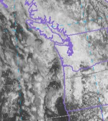
A front went through last night and morning and in its wake we were left with lots of low clouds--stratus and stratocumulus--that held in pretty much all day. (see satellite picture today)

So why so many low clouds during the late spring?

There are several reasons. First, the air behind fronts are much colder earlier in the season and that causes the air to be much more unstable after frontal passage. With cold air above the relatively warm water there is a large change in temperature with height and the atmosphere breaks out into convection---think of your hot cereal pot. The result is showers and sunbreaks!

But there are other reasons. During spring and early summer high pressure--the east Pacific high--is building into our region and the high is associated with sinking motion that decreases toward the surface. Such sinking tends to stabilize the atmosphere, reducing mixing. Thus the ocean is able to inject a lot of moisture into the lower atmosphere that is not mixing out. What does that give you? Low clouds.

Finally, during late spring and summer the continents surround the Pacific warm up relative to the ocean, which heats very, very slowly. With warm continental air moving over the cold water, you have a very stable situation and the warm air gets cooled to its dew point by the cold ocean...the result...you got it...low clouds.

Want to know something REALLY depressing. According to the regional climate simulations being done by my group and others at the UW, global warming will bring MORE low clouds during the spring around here. For example, here is the percent change in low clouds during March, April, and May between the late 1990s and 2090s from one of these simulations. Blue means more low clouds!Why? The simulations suggest a stronger east Pacific high with global warming (more sinking and stable air at low levels) and a warmer continent (which causes the pressure to fall relative to the ocean, and thus more onshore flow).

We just can't win! But don't worry--the rest of the summers will get much warmer, if these simulations are correct.

Finally, let me comment a bit on the whole flap about me be kicked off KUOW Weekday.

Update (some kind folks have created an online petition asking KUOW to reconsider: found here: http://www.petitionbuzz.com/petitions/cliffmassonkuow )

First, let me say I am stunned by the reaction and the many messages of support. I can't tell you how much I appreciate your words. I received over 400 email messages and over 250 comments on my blog, and was greatly encouraged by the Facebook page, which received hundreds of comments. The KUOW Facebook page was overwhelmed . I am still hoping to hear from the KUOW folks, but if not, I have received offers of a regular spot on a few local radio and TV stations. And, of course, there is my blog and the podcast that I plan to start.

This whole situation is really so silly and unnecessary. Let me tell you a little more than has been in the media or my previous blog post. The truth is that I had already caved into most of Katy's and Steve's demands. In our meeting a few years ago over this issue they told me if I talked about math education another time, they would take me off the air. I told them I thought they were completely wrong and were ill-serving KUOW listeners, but I would pull back from discussing math topics. And since that time I HAVE NOT talked about math as all of you know. I never talked about my participation in the lawsuit against Seattle Public Schools about bad math textbooks. I never talked about the State deciding to take on Common Core math standards during this legislative session. I gave in to them because I thought it was more important to serve the KUOW listener community than to fight it out with them. I talked about math on my blog and on the many times I have been invited to talk on other radio stations (e.g., KOMO radio).

So they really got what they wanted. What got me into trouble, what really ended my weather segment, was ONE situation a few weeks ago, where I defended the UW admission's policy. Yes, you got this right-- I was ejected from the UW-owned public radio station for defending the UW. Pretty amazing. The Seattle Times had published a very deceptive article and the 10 AM Week in Review group on Weekday pontificated about it the previous week, continuing to provide the listeners with non-factual information. I had direct knowledge of the facts and had confirmed them with the Dean of Admissions. I would have thought Steve would have thanked me for insuring KUOW listeners were not ill-informed. But that is not what happened. He canceled my next segment and his aide Katy then sent me the threatening ultimatum. I responded very carefully, but told them I could not guarantee NEVER to go off the narrow topic of weather. And for that I was canned. It really appears to me the concern was never about the listeners, the effects of losing my weather segment, or the importance of insuring that listeners get the best possible information. It seemed to be about something else.

The online description of KUOW's weekday states that it is
"call–in, talk show format invites listeners to converse with activists, politicians and practical thinkers on relevant issues and ideas of the day" How is this inconsistent with my talking about math and science education or UW admissions, which are certainly some of the most relevant issues of the day? Why did they allow me to do so for a decade and then change their minds? Why did they not trust their audience to consider the experiences of a long-term university educator? Why is Weekday so dominated by authors pushing their books and so little real-discussion of local issues?

During the past year, the amount of time for the weather segment has progressively dropped, and increasingly they run out of time in the first hour and push me to the second, so that listeners are uncertain when I will talk. Each week I provided Steve with a list of questions to ask me and frequently that list is not used. There has to be a better way to ensure listeners have a more consistent experience.

I hope the program can evolve, and the strong reaction of the listeners shows that many hope that program becomes a more open forum for community discussion. I believe in public radio and I believe in the potential of programs like Weekday. There is much to learn from the hundreds of comments of Weekday listeners found on the Facebook sites. Perhaps the KUOW folks are willing to talk this through with me and find some kind of compromise approach so I can come back. I hope so. But if not, I will find another, more open venue and tolerant environment, for talking about the whys behind the weather and some of the key issues of science and math education.

PS: I did not suggest or encourage the poll on the Stranger Slog (only 8 % wanted me fired) or the Fire Steve Scher Facebook site. I am NOT suggesting anyone should be terminated. One termination is enough for this month.

No More Weather on KUOW Weekday

| comments

For over 15 years, I have talked about Northwest weather, the weekend forecast, and education-related topics on KUOW during Friday's morning's Weekday program.

I have done so as my attempt at educational outreach, to go beyond the basic forecasts given on other media, providing the why behind the weather and to allow local residents a chance to appreciate the grand complexity of the weather of this beautiful area of the world. And occasionally to talk about related educational issues.

Starting tomorrow, I will not have the opportunity to do so anymore on KUOW. On Monday I received an email from Weekday host Steve Scher informing me that the regular weather segments on Weekday will be discontinued.

Now if this was a simple issue of the weather program getting stale, of a need for a new format on Weekday, or of listeners wishing a change, I would not complain. I would have thanked Steve for the opportunity to talk about local weather all these years and moved on.

But that is not what happened.

And the real reasons for the termination of the my segment are more ominous and disturbing. And as I will explain, it has much in common with the recent termination of Principal Martin Floe by Seattle Schools Superintendent Susan Enfield.

My involvement with KUOW began in the mid 90s when I was contacted by them to replace the previous weather person, Art Rangno. I told them that I was not interested in just giving the forecast, but wanted to do scientific outreach, trying to follow (in a modest way) the footsteps of one of my mentors, Carl Sagan, who convinced me that scientists had to communicate directly with the public. I offered KUOW a hybrid: a weather forecast/weather 101 combination and that was accepted.

For over ten years I followed that route, first starting with Dave Beck, Marci Sillman, and Steve Scher and then later only Steve. Many of you seemed to enjoy the material and increasingly I heard from you over the phone and then emails (now several dozen a week). I also started talking about other topics. First, the need for a coastal radar--and the letters and efforts of many of you helped make that happen. But by the early 2000s I started talking about my concerns in education. I am just not a scientist, I am an educator as well--by now having instructed many thousands of students at all levels. I started seeing degradations in math skills and a few times a year I began talking about it and my concerns for the future of our nation.

Sometimes I talked about science education, such as issues with the Seattle Science Center (to their credit, after a discussion on air about it, Bryce Seidel, the director, invited me down to talk about my concerns. And I note that he was responsive in many ways to my concerns--such as the need to entrain more regional scientists in Science Center programs).

But things changed a few years ago. A new producer for Weekday was taken on--Katy Sewall--and on a program I remember well, I talked not only about the problem of declining math skills, but what I thought was the reason--the proliferation of discovery ("fuzzy") math books and the poor instruction by the Schools of Education, including the UW.

A short while later Katy contacted me, telling me I was no longer allowed to talk about math and that Steve concurred. I asked why--she said there were several complaints from the UW Education folks and that it was against "journalistic ethics" to allow me talk about such issues. This went back and forth for a while and I asked to see both Steve and Katy to talk it out.

Their argument--that as a "regular" I was essentially part of KUOW news and thus I could not give my opinion without someone else providing the other side. I noted that I am hardly part of the KUOW news team, clearly indicated my opinions were my own, and they let other "regulars" give their opinions on all sorts of societal issues.

Case in point: Rick Steves. He is the travel guy who is on KUOW all the time. On virtually every recent KUOW visit, he talked about his "passion"--the legalization of pot. They didn't seem to need the other side after he talked about that! So pushing pot legalization is ok, but pushing good math books is not. I just did not follow their logic. And why wasn't my talking about math issues a problem for the previous decade? What had suddenly changed? Were they just giving in to internal UW pressure from the UW Ed School? Was is the fact the UW College of Education was a major contributor to KUOW? I just did not know.

But they remained adamant--if I talked about education topics there was no place for me on KUOW. Remember that I had never talked about non-meteorological issues more than a few times a year at most and I AM a scientist-educator. I regretfully agreed to pull back on talking about math, with their promise there would be some dedicated programs on math. Those programs never materialized.

So we had somewhat of a truce for a year or so, until a few weeks ago.

The Seattle Times had a front page article about UW rejecting strong "straight A" students. And there was more talk about how the UW was rejecting great in-state students so that inferior out of state students could be accepted for big bucks. Joni Balter of the Seattle Times had a big op-ed piece in the paper a few days later saying many of the same things, and during the previous week this issue had been discussed during the second hour of Friday Weekday.

The problem was that I knew from first-hand knowledge that the ST article was highly deceptive and in many ways wrong. The UW does not reject strong straight A students--if someone with an A average gets rejected it is because there was an issue--easy classes, poor SATs scores, or the like. And the truth is that out of state students are generally stronger than in-state applicants. And do you know that the average UW freshman had a high school GPA of 3.75! That is pretty much an A. Grade inflation is a huge issue.

I know all this from first-hand knowledge as the undergraduate adviser for my department, with access to the admissions info, and having talked to the UW Dean of Admissions.

Anyway, because they ran out of time in the first segment, they moved me to right after the 10 AM news--during the "week in review" segment. After giving the weather I then mentioned a few of the facts noted above and had a discussion with Joni and the rest.

That conversation--trying to insure that KUOW listeners had accurate information about UW admissions--- sealed my doom on KUOW. Shortly later, I got a threatening note from Katy:

"Talking about other issues in this context is not acceptable. It does not fit the segment we are offering listeners. If it happens again, we will cancel your weekly appearance."

And her email went downhill from there. I told her that after such a provocative email I would wait a while before responding.

Last weekend I wrote an email to Steve, saying that I would try to work with them, but I could not guarantee that I would never talk about any other subject but the weather forecast. Remember--this is public radio.

A day later I got an email from Steve where he said that the regular weather segments would be terminated.

So that is the story. Not a pretty one.

For me the essence of local public radio is to serve as a focus for the discussion of local issues. You would think there would be room for a scientist-educator, someone interested in talking not only about science, but about the interface between science and how we educate our youth in technical subjects. You would think that Steve and Katy would consider their viewers who have enjoyed learning about local weather. But something else was more important--their wish that I remain "the weekend forecast guy". In fact, during the past year, the time they allowed for my segment has progressively decreased, so that I rarely had enough time to coherently complete even my local weather explanations.

So does my situation parallel the Enfield-Floe case? I got into trouble for criticizing the local education orthodoxy (at the UW)---it appears he did the same thing (with the Seattle School District bureaucracy). He was dropped with little apparent reason. I was dropped for reasons that I believe are without merit.

The question is what will happen now. If you have enjoyed what I have done in the past and wish it to continue, perhaps this can be turned around. Perhaps if enough of you---listeners to KUOW, contributors to KUOW, and those interested in public radio can contact the folks at KUOW they might change their mind...in the same way Superintendent Enfield changed her mind when the teachers and students at their school learned of the firing of their principal (some KUOW emails are found below)

My other option is to try other approaches: perhaps a podcast on my blog or moving to another radio station. Anyway, thanks for listening. Whatever happens, I have enjoyed the interactions with many of you over the years.

And I promise to get back to weather on my next blog!


Emails:

KUOW Weekday:

Steve Scher
sscher@kuow.org

Katy Sewall
katy@kuow.org

KUOW News Director:
Guy Nelson: gnelson@kuow.org

Chair of UW Board:
Allen Steinman: asteinman@badermartin.com

Wayne Roth, KUOW President and CEO
wroth@kuow.org


70F on Friday?

| comments

Time to get out the shorts, sunglasses, and beach gear.

After one of the coldest springs on record it appears that temperatures will climb into the 70s on Friday and perhaps for a few lucky folks tomorrow.

The air is progressively warming and today temperatures hit the mid 60s in much of the lowlands. Warm enough to get our old friend, the Sound Breeze, to start up. The Sound Breeze is our regional sea breeze that is caused by the difference in temperature between a relatively warm Puget Sound interior and the cooler water to the north. Here are some winds from the Washington State ferries this afternoon:

Moderate (16-18 kt) northerlies associated with the Sound breeze in mid-Sound. As the land gets warmer, the Sound breeze strengths. Tomorrow the air will warm further and high pressure will build along the coast (see graphic). There will be no offshore flow, so don't expect a scorcher! Another step up of a few degrees.


On Friday, this benign process will continue, with a few more degrees added to the total. Probcast, the UW high-tech prediction system, which is generally very good for such dry, warm periods, is going 70F at Sea Tac on Friday (see graphic).

And if you want real warmth, head over to eastern Washington, where upper 70s and 80s will reign on Friday (see probcast Friday max temp max on Friday below)

The weekend? Cooler, with a few light showers. Sorry....

Finally, beautiful example of cirrus moving in aloft midday on the Olympics cam. And you can see cumulus forming over the Olympics....but the atmosphere is too stable for much development.

Seattle Schools Lawsuit, Enfield, and Common Core

| comments

I would like to update you on the math lawsuit against Seattle Public Schools, reveal an interesting encounter with Seattle Superintendent Susan Enfield, and tell you the depressing tale of our state's math curriculum.

As many of you know, I was involved in a lawsuit against Seattle Public Schools with two other local residents, Martha McLaren and DaZanne Porter, over problems with Seattle's adoption of the Discovering Math series. This math curriculum was found to be"unsound" by the WA State Board of Education and is a very poor discovery-type math text (students are not taught concepts but must "discover" them for themselves, lots of calculators, little learning of basic skills). The Seattle School Board adopted them, knowing about the problems and without a proper review.


In Feb. 2010, King County Superior Court Judge Julie Spector ruled in our favor, finding the School Board's decision to be "arbitrary and capricious." She instructed the board to review their decision. All they had to had to do was to go through a thorough review of these books. The District refused and decided to spend many thousands of dollars in appealing the case. Just amazing--that money was critically needed for student support. The Court of Appeals did in fact overturn Spector's courageous decision, based on the usual reticence of the courts to get involved in educational decisions.

Although our lawyer felt our case was sufficiently strong that we might prevail in a further appeal, we decided not to proceed with a lawsuit and instead put our resources into getting at one of the sources of the problem--the dysfunctional, rubber-stamping school board running the Seattle School District. Furthermore, we did not want the district to waste any more money on the lawsuit. Two of the school board members who voted for the bad math books--with clear knowledge they were unsound and damaging to students-- are Peter Maier and Sherry Carr. They should NOT be reelected. (Note--some of the most recent additions to the Board show substantial promise: Directors Patu and Smith Blum--and Director DeBell was a leader in trying to stop the bad math). Replacing a few of the bad apples could result in a far more active and functional board.

During the past few months, the ineptness of the current school board and the administrators they have selected have been amply demonstrated, requiring the firing of Marie Goodloe Johnson, the past superintendent. Their poor choice for interim superintendent (Susan Enfield) is now in trouble, having fired and now forced to rehire the principle of Ingraham High School.

Cartoon courtesy of David Horsey and the Seattle PI.


Now here is a story that has not been in the newspapers. Several parents involved in improving math education secured a meeting with Susan Enfield BEFORE the Discovering Math books were selected. At that time she was the chief academic officer of the district. They told her about all the weaknesses of the books and reviewed objective studies that demonstrated that they are particularly damaging to minorities and English As a Second Language learners. She listened and smiled and did nothing. Thus, it is extraordinarily hypocritical that she decided to fire Ingraham HS Principal Floe for poor math scores at his school (which has a large minority population) since she KNOWINGLY allowed a book that preferentially damages such groups to be used district wide. What is also not well known is that Principal Floe has been open to using good math books in his high school, rather than using the fuzzy, discovery texts preferred by the central administrative offices of the Seattle School District.

I can't help but ask the following question: if Martin Floe deserved to be fired for the supposed lack of performance of his high school, shouldn't the Chief Academic Officer of the district (Susan Enfield) have been fired for the overall district-wide stagnation of academic performance, particularly of lower-income students? Why does the buck stop at the principals' door and not at the door of higher (and very high price) administrators like Enfield and her associate Bree Dusseault?

My only hope is that recent demonstration of management and oversight incompetence by the Seattle School District will result in the replacement of School Board members Maier and Carr with people willing to ask questions, and the replacement of the Interim Superintendent Enfield and her equally incompetent, management staff (like Bree Dusseault who recommended the firing). Then the district can take some positive steps like replacing the math textbooks for K-12, since all of them are hopelessly fuzzy and poor.

Finally, some have asked what has happened with the Common Core standards. I am sad to note that the State legislature has done nothing, which means (as a result of legislation passed last year) that our state will now adopt the new "national" standards. Not standards created by a Federal agency and carefully tested to prove their worth. Rather, standards that were created by a group empowered by the National Governor's Association and the State Superintendent's association, and strongly pushed by the Gates Foundation. These standards have major problems (such as being nearly unreadable), have never been tested in the classroom, and associated assessments do not exist. Furthermore, we are now scrapping the new, and quite good, math standards we just adopted--standards that cost our state over 100 million dollars . Finally, we have essentially given up local control of our educational standards to individuals that are not responsible to anyone.

My group, wheresthemath.com, has talked to several state legislators who sheepishly admitted they are very uncomfortable with their votes, but that it was highly political, with the Governor, the Obama administration, and well-connected/well-financed foundations supporting this agenda. Not long ago, the Gates Foundation was pushing small schools as a solution to student learning. After wasting hundreds of millions of dollars, they admit it didn't work. Now it is Common Core standards. Don't get me wrong--strong, well-written and well-tested national standards could be useful models for the nation. Common Core is not those standards.


Well, all of this education stuff is getting depressing! I need to get back to weather. But I wonder sometimes that great nations have a self-destruct mechanism and that our educational system is a reflection of that. Our education industry is so sick-- Ed Schools that follow trendy, unproven ideas, teacher's unions that work against accountability, school districts that don't let empirical information on program effectiveness guide their work, school administrators without the experience and knowledge to know what they are doing (like here in Seattle!), school board members without the time and tools to oversee complex district activities, and much more. Grade inflation and "don't damage their ego" approaches to student learning have allowed an atrophication of student attitudes and initiative. Other nations are doing a far better job than we and we refuse to learn from them.

Just so sad and so unnecessary. We could do so much better.

An Unusual Spring Rain

| comments

Our rain has even made CNN:


SUNDAY NIGHT UPDATE: Sea Tac broke its daily records for both Saturday and Sunday.
A number of stations in the south Sound received 1.5-2 inches of rain today.

For days the numerical models indicated substantial rain over the weekend, and yesterday's runs really took me back. Here is the forecast 48-h rainfall totals ending 4 AM on Monday. The pinks indicate 1.28-2.56 inches stretching from normally try eastern Oregon, across the Cascades, into south/central Puget Sound territory, and then over the Olympics. Even some scattered blacks (2.5-5 inches!)

The rain started east of the Cascades on Saturday and moved into western Washington during the early evening. Here are the radar images for last night (8 PM) and Sunday morning. Serious rain!


And this rain is NOT coming from a pineapple express (moisture streaming out of the SW, starting in the tropics and subtropics), but from the southeast and is associated with a deep upper trough (see upper level map).

This pattern brings clouds and precipitation to southern California as well. Snow is hitting the Sierras and even the California coastal mountains.

Even the satellite imagery shows how complex the situation is. Here you can see the band over us, but you can also see a low circulation off of northern CA.


The models are verifying well...here is the 24-h precipitation (ending roughly 7 AM Sunday) from the cooperative observed network called CoCoRahs. The south sound is getting hammered with 1-1.5 inches already.

Some 24 hr rainfall totals SO FAR (8 AM Sunday):

1.14 inches Sea Tac
3.23 in Lester, WA
1.70 in, Black Diamond
1.24 in, Auburn
1.3 in McChord, Gig Harbor

Many stations will break their daily records today and some may reach in one day their normal monthly totals.

And don't forget eastern Washington where the Mazama-Chelan area received 1-1.5 inches. And Mark Albright, past WA State Climatologist, noted that Yakima with 1.76 inches in the past 18 hours alone is wetter than any May since 1948 when 2.76 inches of rain fell. The 2nd wettest May total was 2010 with 1.46 inches in Yakima. The total so far in 2011 is 1.90 inches through late morning 15 May 2011. Mean May precipitation in Yakima is 0.54 inches.

But want some good news? Most of the models are now indicating a major improvement towards the end of next week and next weekend....we are talking warm and getting into the 70s! Dry. Suitable for raking out the moss in your grass.
 
Support : Creating Website | Johny Template | Mas Template
Copyright © 2011. The Weather - All Rights Reserved
Template Created by Creating Website Published by Mas Template
Proudly powered by Blogger