Here is the latest 24-h rainfall map from Seattle Rainwatch. Heavy rains continued last night and the focus was in a band stretching from the SW side of the Olympics through south Seattle into the foothills. A number of locations have received 2-3 inches with 3-5 inches on the western slopes of the Cascades. During the last 24-h (ending 8 am) Shelton has had 3.8 inches, Quinault 5.35 and the NWS has a flood warning out for the Skokomish River.
But things are about to change....the latest radar shows the wet front band is about to move through central Puget Sound
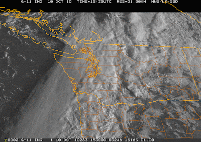
 and the latest visible satellite image shows not only the frontal band...but clear skies behind (see images).
  Unfortunately, improvement will be slow for central Puget Sound where a convergence zone will set up today. Here is the forecast precipitation ending 11 AM:
and the forecast cloud cover at 2 PM:

So if you want bright sun today and you are in western WA..you can have it...just get out of the convergence zone. That is what I am going to do!


