
Yesterday was very wet, particularly over NW Washington...take a look at the 48-h rainfall ending Saturday morning from RainWatch (www.atmos.washington.edu/SPU), a system we developed for Seattle Public Utilities (see graphic).
 Some places--N. Whidbey and nearby locations--had 1-2 inches of rain. I had some people asking why the rainshadow area was so wet. The reason: the winds yesterday were from the north and northeast and Sequim and N. Whidbey were no longer in the rainshadow of the Olympics.
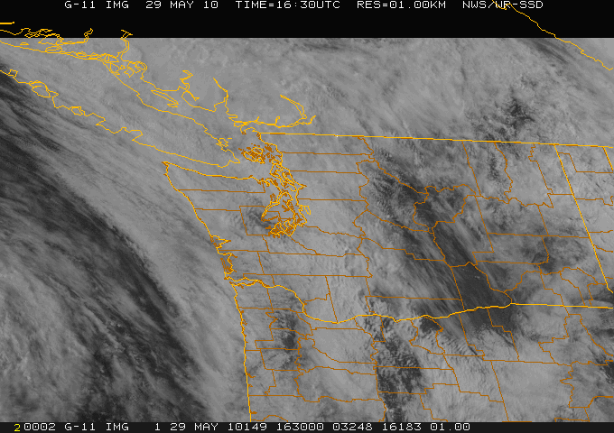
Now lets get to the depressing forecast. Right now (Saturday morning), there is considerable cloudiness over the region (see image). With NW flow aloft the rainshadow is now TO THE SE of the Olympics where it is normally wet (so head to Shelton!) There is clearing over eastern Washington to the east of the Cascades as well...a very good place to be today. Drier air is moving in from the west, and the situation should improve starting at the coast. Upslope flow should keep clouds and light rain over the western slopes and crest of the Cascades and a Puget Sound convergence zone could keep some clouds and showers over northern Puget Sound.
Eastern Washington still looks good.
But that is pretty much the same story as I told you yesterday.
The problem is that the next Pacific disturbance is moving in faster than initially forecast. Here are the new forecasts for 3-h precipitation for tomorrow, ending 8 am, 11 am, and 2 PM. The rain is on the coast by daybreak and moves into western Washington during the morning. Eastern Washington remains dry on Sunday.
This situation is a good example of a timing error in our simulations--the system is coming in about 6-hr earlier than suggested by yesterday's forecast model run. And on top of it all, the NWS weather radar at Camano Is. is broken again. In such situations I look at the Canadian radars:
http://www.weatheroffice.gc.ca/radar/index_e.html?id=WUJ
or the Portland radar.


 Monday will be showery and generally cloudy, with a few sunbreaks, particularly in the afternoon.
Anyway, the Sunday window is closing...do something right after breakfast and you might be fine, but by lunchtime the murk will be back.


